Primorsko in Bulgaria – information, landmarks and beaches.
The town of Primorsko, Bulgaria is a large Black sea resort and has superb qualities for sea holiday combined with a lot of fun. Its location near the Ropotamo Reserve provides plenty of opportunities for nature walks and historical monuments. Also, folklore festivals take place here. The area offers a variety of attractions that make it suitable for both a relaxing family holiday and a stay with active nightlife with lots of parties and fun.
The best things to do in Primorsko – map, beaches and landmarks
USEFUL: For planning your visit to the place or accommodation in the nearby settlements, can use the collection of assistive tools – Google Road Map with calculator in km, flights to Bulgaria, rental cars, weather forecast, hotel search, timetables of buses in the region, see this link.
The town is 50 km south of Bourgas, 18 km south of Sozopol and 15 km north of Tsarevo. There are regular buses to the neighbouring resorts as well as a bus to the capital of Bulgaria – Sofia. Also, Primorsko offers a wide selection of accommodation – hotels, guest houses, small family hotels, lodgings, villas, and bungalows – the accommodation base is over 500 000 places. There are many restaurants, fast food pavilion, taverns, bistros, pizzerias, bars, and pubs to satisfy every taste. In addition, for the entertainment of tourists, there are many attractions, including a boat trip along the river Ropotamo, aquapark, water skiing, surfing, jets, yachts and even flights with small sports jets from the airport in Primorsko.

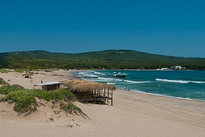
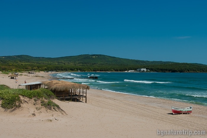
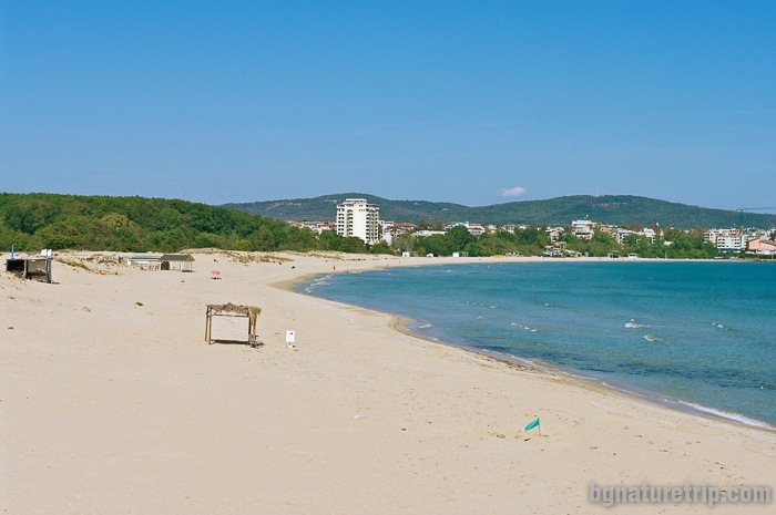
The beaches of Primorsko
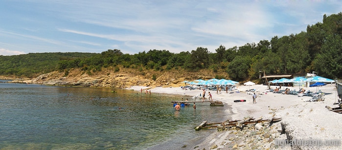
They are one of the longest on the Bulgarian Black Sea, with a total length of 5 km and a width of 100 m. The beaches are two – “North” at the Stamopolu bay and “South” at the Diavolski Bay.
North Beach
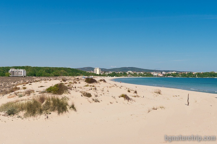
The length of the north beach is 2.5 km, and its clear waters and clean, golden sands attract thousands of tourists every summer. Behind it there are the dunes of Stamopolu bay declared as a natural landmark.
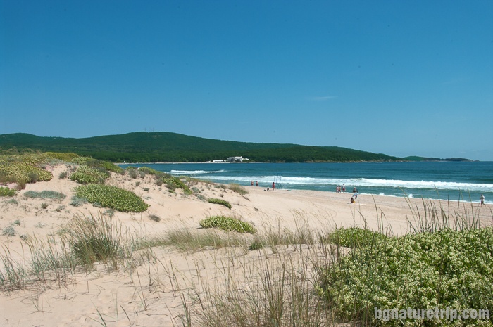
Their height reaches 3-4 m, and there you can see rare sandy plants. Behind the beach is the “Stamopolu marsh”, which has given the name of the bay. From the Greek word ” στόμα” (stoma) means mouth. It is related to the underwater spring, which is at the bottom of the marsh and connects it to the sea. Similarly like mouth, it sucks seawater and pours it into the swamp. Therefore in this way, it is continually refreshing it.
On the northern part of the beach is the building of the deserted Perla (Pearl in English) residence. At this point, it is unusable. The section of the beach enclosed by the two breakwaters is called “Little Pearl”. Behind the beach, there are meadows and forest, and the idea for camping on them seems attractive to some tourists. However, this is not allowed, and for the intruders, there is a risk of a fine.
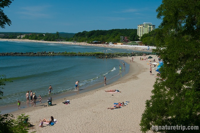
South Beach
From the south side of Primorsko is the South beach. The other its name is “Dyavolski” beach (“The Devil’s beach” in translation). It is 2.4 km long and reaching the “International Youth Center Primorsko”. Its amenities are no less attractive than the North beach, and it is also a trendy place for sunbaths.
Some people who prefer bungalows, as a place for accommodation, can rent them around the “International Youth Center Primorsko” (ММЦ in Bulgarian), which is located in the southern part of the beach.
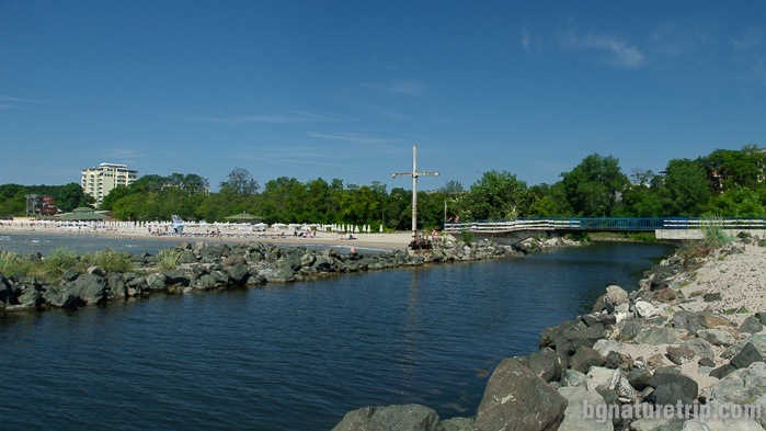
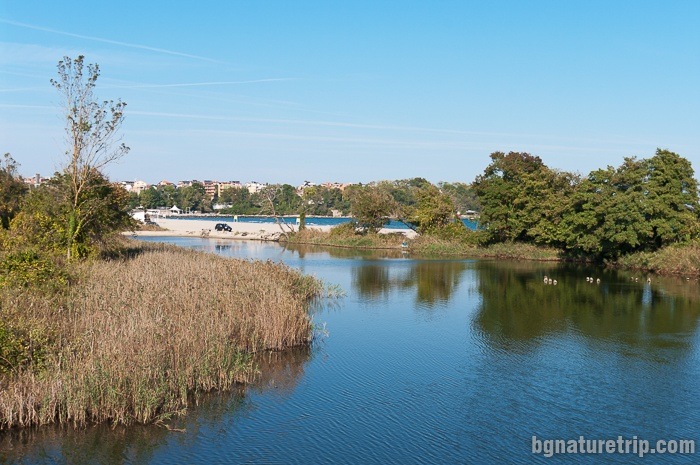
The Devil’s Marsh
The name “Diavolski” beach (in translation “Devil’s beach”) should not be considered as a bad sign. It is associated with the Devil’s marsh, which is nearby. Оf its area – only 1 acre is water, and the rest is a marsh and reeds. Therefore, only the Devil can orient here, as the local people loved to say in the past.
Because of the swamp, so is called the river, whose mouth is here. It crosses the specially designed small pedestrian bridge. Precisely this “Diavolska” river (“The Devil’s River”) has a crucial role in the old name of Primorsko. In the past, a couple of centuries ago the bridge was wooden, part of the main coastal road connecting big towns Pomorie and Sozopol with Constantinople (Istanbul in the present). Since its foundation in 1879, until 1934, Primorsko was called Kyupria, which in translation from Turkish köprü (kyupru) means a bridge.
Offers for hotels in Primorsko
Booking.com
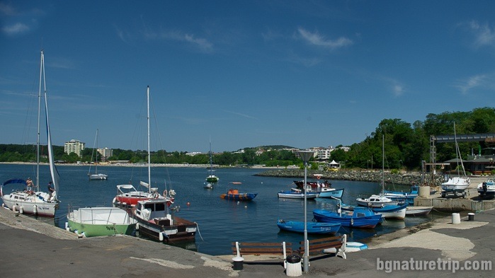
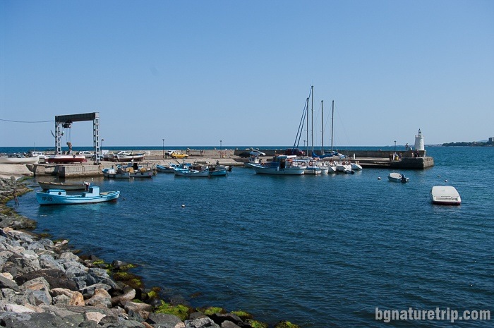
The port of Primorsko
On the northern side of South Beach, there are a yacht harbour, fishing boats, and a lighthouse. From here, yachts go for a trip to Cape “Maslen nos”. During this trip, you can see “The seal’s cave”, fjord bays, and visit the wild bay “St. Paraskeva”. At the request of passengers, they could go down the beach at Cape “Maslen nos” and take rest. After that, they can go back with some of the next boating trips.
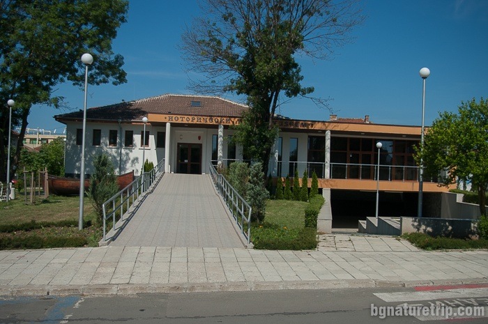
Historical Museum in Primorsko
The historical museum presents the finds discovered on the territory of Primorsko Municipality. Of particular interest are the objects found at the ancient Thracian cliffs – sanctuary Beglik Tash. This sanctuary is one of the most famous historical sites in the whole of Bulgaria and attracts tens of thousands of tourists from all over the world. The ceramic vessels prove a connection with the peoples of Crete and Egypt in the III century BC.
Also, at the museum could be watched a short holographic film with a Thracian priest, inviting visitors to go to Begliktash. Besides, you can see finds from the “Lion’s Head” (rock formation in Ropotamo reserve); Cape “Maslen nos”, the mouth of Ropotamo River, “Lobodovo Kale” fortress, the Urdoviza fortress and others.
Short history of Primorsko
The area around Primorsko was settled quite late in 1879. Then it is founded the village of Kyupria. The whole peninsula (where is Primorsko now) was wholly deserted, covered with a thick oak forest stretching over a large area. Later, after people settled here, only the woods around the Devil ‘s marsh called Koria preserved. In 1934, the name Kyupria changed to Primorsko, which became a town in 1981.
The ancient people have chosen other places in the vicinity for the creation of their habitations. Some of them are the mouth of Ropotamo, the deserted city at Ranuli fortress (also called “The Lion’s Head”), the port at Cape “Maslen Nos”, the fort “Lobodovo kale”. The earliest finds (3rd millennium BC) come from the mouth of Ropotamo where there was a prehistoric village that has sunk.
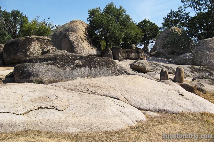
Ropotamo reserve
During the different epochs, Thracians, Greeks, Romans, Byzantines, and Bulgarians lived in the region. The ruins of their buildings, shrouded in mysteries are located into the forests of Ropotamo Reserve and its surroundings.
Indeed, their visit inevitably gives the traveller feelings of delight in the skill of the ancient builders, and admiration for the natural beauties of the forest.
Walking is only on the indicated and allowed hiking trails according to the rules of the reserve. Most of the routes are short, easy and suitable for any age group, for more information look at the attached map and detailed descriptions. To enter the reserve, you have to go to the northern side of Primorsko, passing by the “North Beach” and the deserted “Perla” residence. Further, continue along the asphalt road to Beglik Tash.
What to see around the town of Primorsko
- The mentioned above Begliktash and Ropotamo Reserve, which are 3 km from Primorsko
- A boat trip along Ropotamo River (4 km)
- Kiten city ( 6 km)
- “Yug” campsite and “Coral” Beach ( 8 km)
- Arkutino Beach (8.5 km) – between Sozopol and Primorsko
- The town of Sozopol (22 km), with its historical landmarks. Also, it offers excellent seaside holiday opportunities.
- The town of Tsarevo (17 km) – with beautiful bays, historical sites and a museum. From there can go to the Strandzha Nature Park – the largest protected area in Bulgaria.
USEFUL: To get a quick and easy idea of where these places are – see the destinations marked on our Google map. There all the landmarks we’ve written about, are marked as tags with links.
To plan your trip to them, you can use the selection of assistive tools: Google Road Map with calculator in km, flights to Bulgaria, rental cars, weather forecast, hotel search, timetables of buses in the region.
Offers for hotels in Primorsko
Booking.com