Sozopol: Cape Agalina
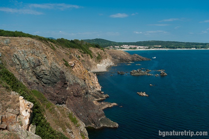
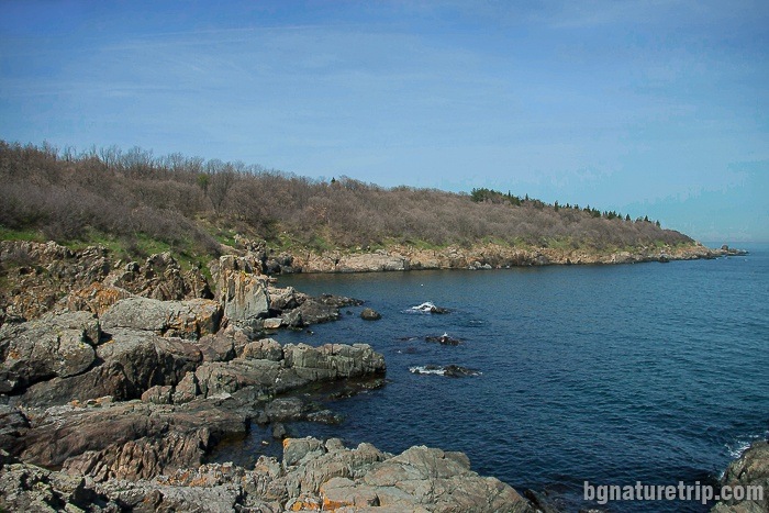
The location of Cape Agalina is between the town of Sozopol and the Resort Duni. It is a collection of small bays and rock formations in an area with specific coastal flora and fauna. Tourists mostly visit rock phenomenon resembling a fjord. Also, the place is easily accessible, and walking is minimal. It is about 9 km south of the centre of Sozopol. Besides, the whole area around the Cape is declared a natural landmark.
How to get to Cape Agalina – map, route and GPX file Download file: Cape-Agalina-EN.gpx GPX file
USEFUL: For more information on how to open GPX files with a smartphone, see this link .
For planning your visit to the place or accommodation in the nearby settlements, can use the collection of assistive tools – Google Road Map with calculator in km, flights to Bulgaria, rental cars, weather forecast, hotel search, timetables of buses in the region, see this link.
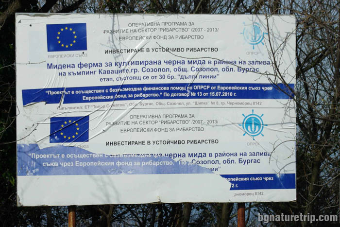
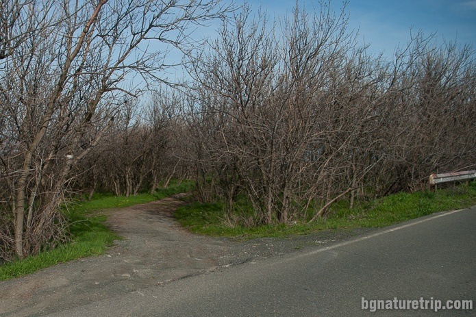
Shortly before the penultimate bend leading to the Resort of Duni (starting from Sozopol), there is an exit in the left with an information board. It is written in Bulgarian “Мидена ферма за култивирана черна мида ” ( “Black Mussel Farm” in translation). You can park a car here, then continue on the path on foot. Moreover, our advice to you is if you use an application to open a GPX file (with smartphone or GPS device), load it while you are in the car and travel to the location. In summer, when everything is overgrown with vegetation, the sign and the path could be unnoticed.
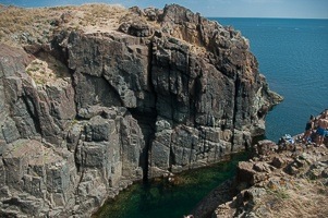
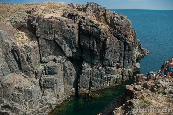
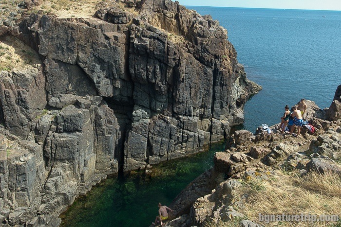
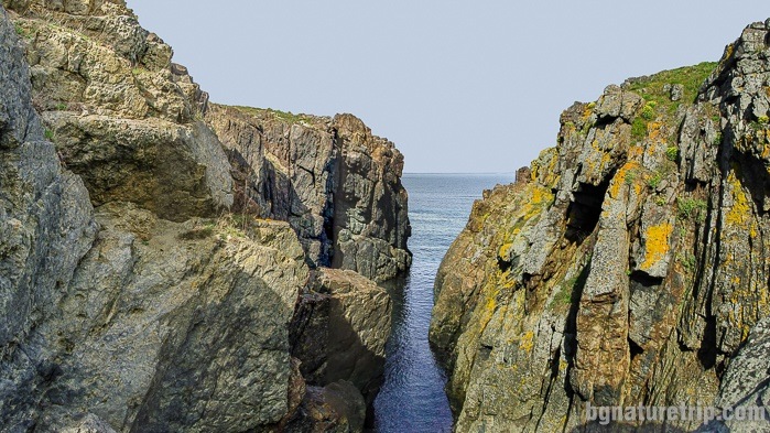
After 300 meters of walking along the dirt road, you will reach the long crack. Its location is on the north side of the Cape. The length of the cleft is about 25 m long, and the steep slopes are 6 m high. In the summers daredevils come here who like to leap into the sea.
Whose is the name of the Cape
Trifon Trifonov’s thesis in the book “700 Names on the Bulgarian Black Sea Coast” about the name of the Cape is interesting since there is no saint canonised by the name of St. Agalina. The name origins from an old pagan custom according to which, in severe and prolonged storms, the women of the fishermen of Sozopol threw a handful of soil, at the Cape and said: “Να γαληνη” (Na galini in pronounce). In Greek, this means “to be quiet” referring to the sea.
Later, after the adoption of Christianity as the official religion in these territories and to forget the old pagan custom, the Cape was called Saint Agalina. This name was appropriate because of the phonetic similarity. As a result, in the intention of promoting the new meaning of the name, a chapel with the same name was built. Although we did not find it in our visit on the Cape in publications of archaeologists, its remains are mentioned, that have been studied in the recent past.
Pagan custom has survived through the ages
From the book “Traditions and Customs of Sozopol”, we learned that pagan custom, to throw soil into the sea to calm it down, people indeed practised at the beginning of the XX century The author, of Greek origin Velasia Vafiadou, was born and lived here at that time. Then, the population of the city had been still only Greek. She tells that somewhere in Sozopol, on its high and steep shores, there was a chapel, but with the name “St. Galina.” Indeed, such a saint existed and was canonised. When the weather was terrible people lit a candle and took a handful of soil from that chapel.
However, in our walks around the city, we didn’t find it, probably it had been destroyed.
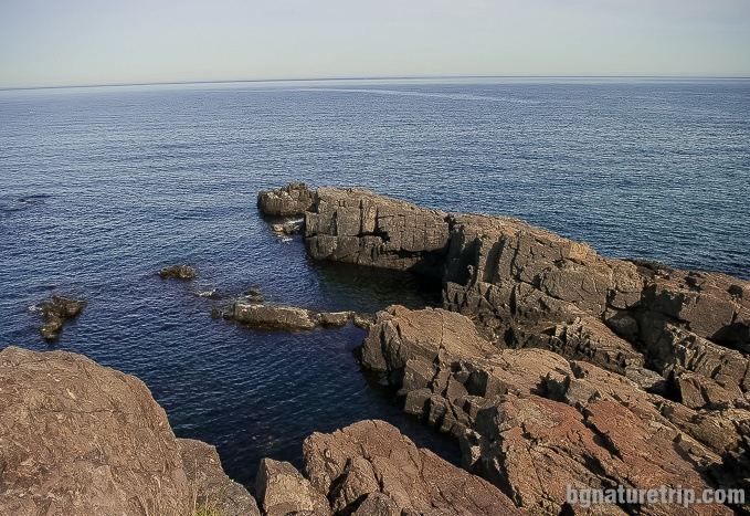
South part of the Cape Agalina
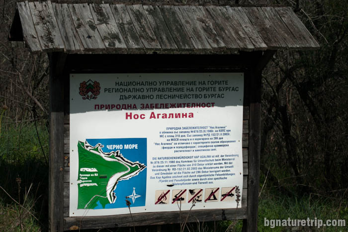
Six hundred meters, further, in the south, on the asphalt road there is another path, leading to the most elongated rocks of the Cape. There is an information board on the exit, with the sign of Regional Management of the Bourgas Forests. This association manages the locality. Besides, the whole field around the Cape is declared a protected area.
Preservation of the protected area
The area around Cape Agalina has forest status and is within the boundaries of a protected area called “Nos Agalina”. Therefore some rules should observe when visiting to protect natural resources.
To put it briefly – do not throw away waste, do not tear plants, do not light a fire, no camping, and let the place look like you’ve found it!
For more details, or if you intend to carry out particular activities other than a simple tourist walk, the full text of the laws can read here:
2. A management plan for protected area “Nos Agalina” (in Bulgarian)
The exact boundaries of the protected area can see here: https://gis.wwf.bg/mobilz/en/ (“Protected areas in Bulgaria” layer must be bookmarked).
Continue of the walk
- Other rocks, similar to fjords like these, but even more impressive in size, can be seen at Cape Maslen Nos, near Primorsko (25 km in the south)
- Other exciting protected areas for scenic views near Sozopol are Bakarlaka and Ropotamo Reserve, Primorsko (24 km in the south)
- Alepu Beach ( also known as “Chauffeurs’ Beach”) – 5 km in the south
- Arkutino Beach – 8 km in the south
- Boat trip along Ropotamo River (12.5 km)
USEFUL: To get a quick and easy idea of where these places are – see the destinations marked on our Google map. There all the landmarks we’ve written about, are marked as tags with links.
To plan your trip to them, you can use the selection of assistive tools: Google Road Map with calculator in km, flights to Bulgaria, rental cars, weather forecast, hotel search, timetables of buses in the region.
If you are planning a more extended stay in the area, it is a good idea to choose the town of Sozopol, as it has many hotels and apartments for accommodation, as well as lovely beaches and numerous historical sites for viewing.
Offers for hotels in Sozopol
Booking.com