Sozopol: The “Chauffeurs’ Beach” in the Alepu area
The “Chauffeurs’ Beach” is one of the most famous and attractive wild beaches on the South Black Sea coast. It is easy to access and is 37 km away from Bourgas city. Because the beach is spacious, long and not crowded, it is an excellent place for those who want quiet tranquillity on the beach. Besides, it is close to the natural landmark “Alepu Swamp” and is also popular with the name “Alepu Beach”.
Where is the”Chauffeurs’ Beach” (Alepu) around the city of Sozopol, Bulgaria
USEFUL: For planning your visit to the place or accommodation in the nearby settlements, can use the collection of assistive tools – Google Road Map with calculator in km, flights to Bulgaria, rental cars, weather forecast, hotel search, timetables of buses in the region, see this link.
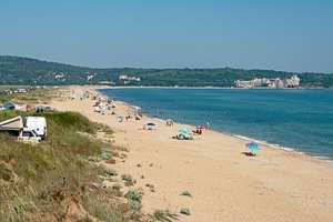
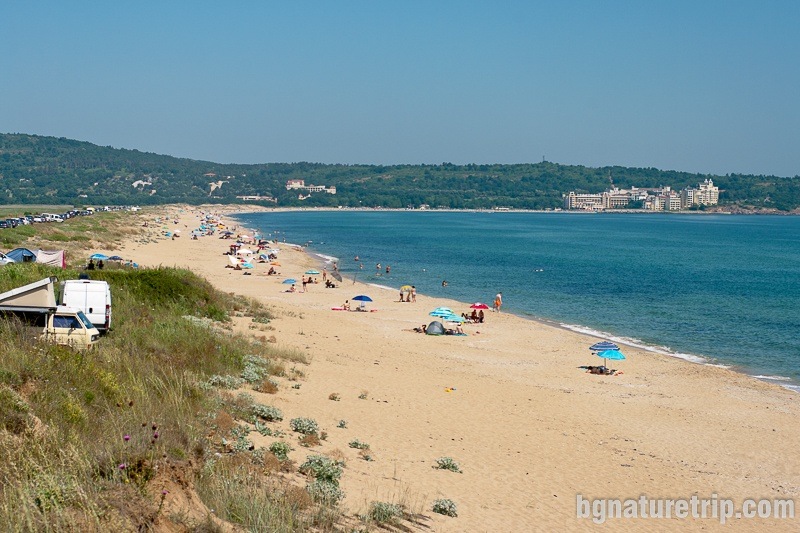
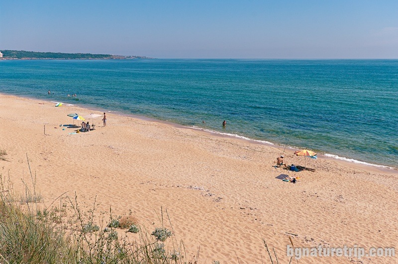
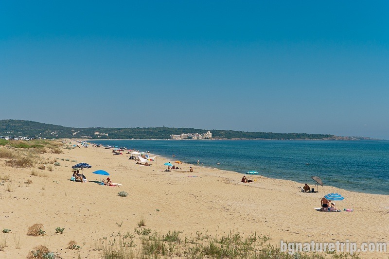
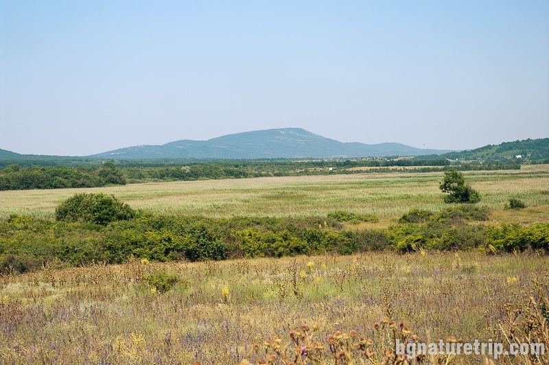
The location of “Chauffeurs’ Beach” is between the Duni Resort (north) and Cape Humata (south). It is 10 km south of Sozopol and 14 km north of Primorsko. Its length is nearly 3 km, and its width reaches 70 m. As a result, with these characteristics, it is the second-longest beach on the South Black Sea coast after the sand strip at Pomorie Lake. Behind the beach, there is an asphalt road (the old road connecting the settlements on the Southern Black Sea coast). For this reason, the beach was called by local people – the “Chauffeurs’ Beach”.
Characteristics of the “Chauffeurs’ Beach”
Employees of the Duni Resort manage the northern stretch of the beach (about 400 m), and there are umbrellas, sunbeds and a lifeguard. Further, the next three kilometres are the wild part of the beach. There is neither lifeguards nor beach amenities, and it is calm. For this reason, people looking for silence and relaxation prefer it.
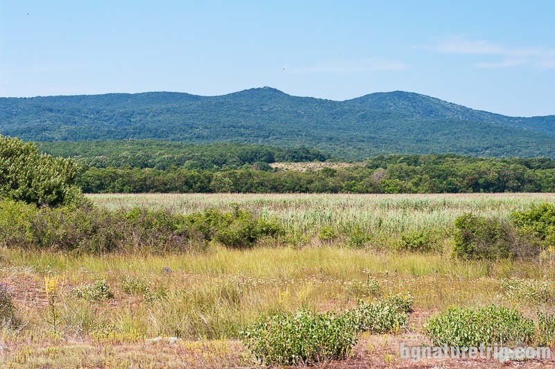
Alepu swamp near to the “Chauffeurs’ Beach”
Behind the beach lies the Alepu swamp, which is also a natural landmark for the conservation of waterfowl and the rare Water caltrop (Trápa nátans).
It is part of the Complex Ropotamo Ramsar area, as well as of the Natura 2000 network. Also, the Via Pontica migration route crosses this area. However, there are no paths to walk around the swamp, and any hiking walk would be accompanied by a lot of difficulty and the need for appropriate clothing and accessories.
Preservation of the protected areas
The areas around the swamp Alepu and the dunes behind the Chauffeurs’ Beach are declared protected areas. Therefore some rules should observe when visiting to protect natural resources.
To put it briefly – do not throw away waste, do not tear plants, do not light a fire, no camping, and let the place look like you’ve found it!
For more details, or if you intend to carry out particular activities other than a simple tourist walk or stay at the beach, the full text of the laws can read here:
- The swamp Alepu – current prohibitions and regimes ( the page of Bulgarian “Executive Environment Agency”)
- The dunes Alepu – current prohibitions and regimes ( the page of Bulgarian “Executive Environment Agency”)
Origin of name Alepu
The source of the word Alepu is Greek and means fox. Probably, it is related to the peculiarities of the swamp that in the past was “cunning as a fox”. At different seasons, either it was approaching the sea, or it was moving away.
Continue of the walk
In the north direction, you can try these suggestions:
- The rock formation – the fjord at Cape Agalina. That Cape encloses the beach in the north (3 km)
- The town of Sozopol with its beaches and historical sites (10 km)
In the south direction, you can try these suggestions:
- Another beautiful beach with a wild and guarded part – Arkutino Beach (3.5 km). In addition, from the beach begins hiking trail leading to the mouth of the Ropotamo River
- Boat trip along the Ropotamo River. The point where the boats start is 9.5 km from here in the direction of Primorsko.
- The town of Primorsko (14 km) its beaches and museum
- Thracian Sanctuary Beglik Tash (18 km)
- Ropotamo Reserve and the many hiking trails crossing it (19 km)
USEFUL: To get a quick and easy idea of where these places are – see the destinations marked on our Google map. There all the landmarks we’ve written about, are marked as tags with links.
To plan your trip to them, you can use the selection of assistive tools: Google Road Map with calculator in km, flights to Bulgaria, rental cars, weather forecast, hotel search, timetables of buses in the region.
Deals on hotels in the Duni area
Booking.com