
Ahtopol – romance, sea, history and nature
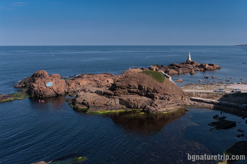
Ahtopol is the southernmost city on the Bulgarian Black Sea Coast, located at the foot of the Strandzha Mountain. It is suitable for a quiet and peaceful holiday at sea, together with sightseeing of historical and natural landmarks. Inevitably, walking along the seafront promenade with the fishing pier, the lighthouse and the high rocky shores create dear memories in every visitor, that provokes a desire of returning.
The best things to do in Ahtopol – map, landmarks and beach
USEFUL: For planning your visit to the place or accommodation in the nearby settlements, can use the collection of assistive tools – Google Road Map with calculator in km, flights to Bulgaria, rental cars, weather forecast, hotel search, timetables of buses in the region, see this link.
Ahtopol is 77 km south of the regional city Burgas and 14 km south of Tsarevo.
There are regular buses to them, and in summer – a bus to the capital. As a resort town with the main branch – the tourism, Ahtopol offers many accommodations – hotels, guest houses, rental apartments, bungalows, lodgings and more. There are also many dining establishments – restaurants, fast food pavilion, bistros, pizzerias, bars, and pubs to satisfy every taste.
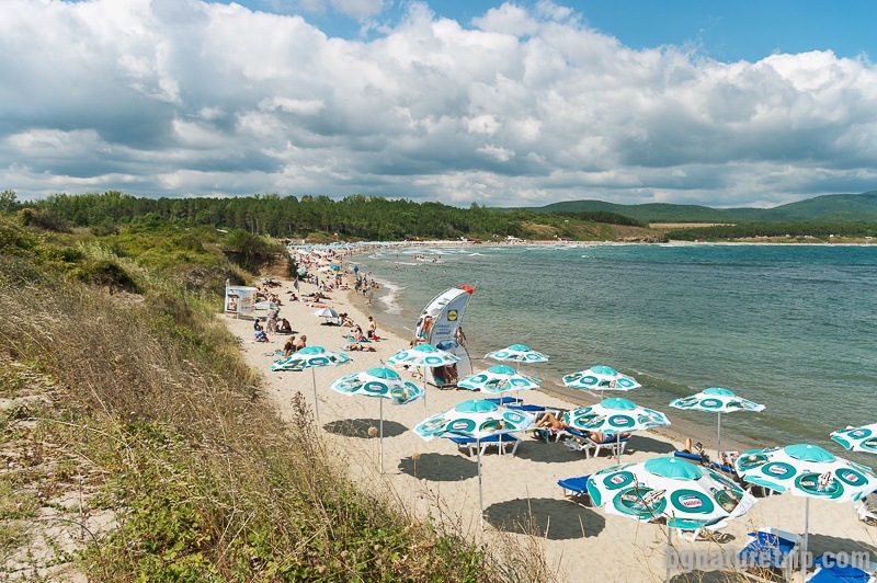
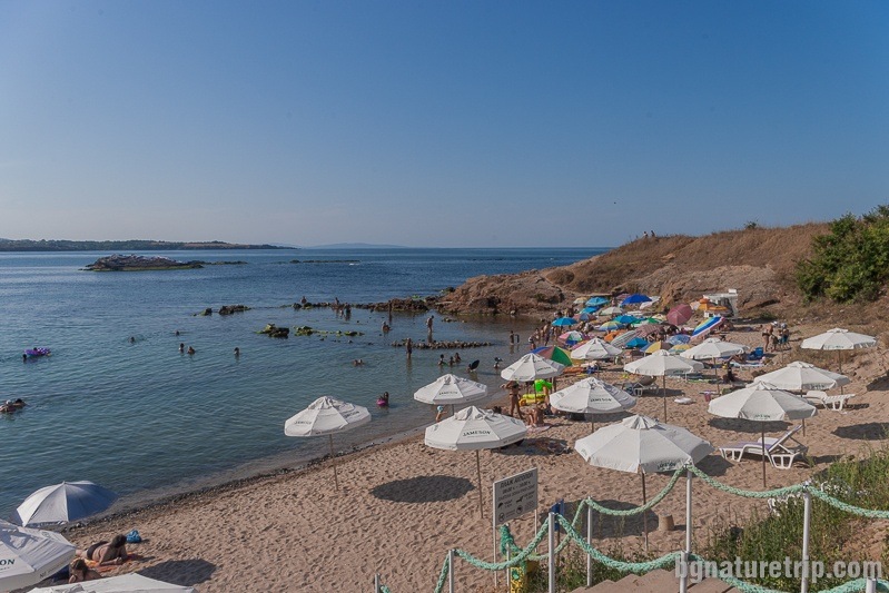
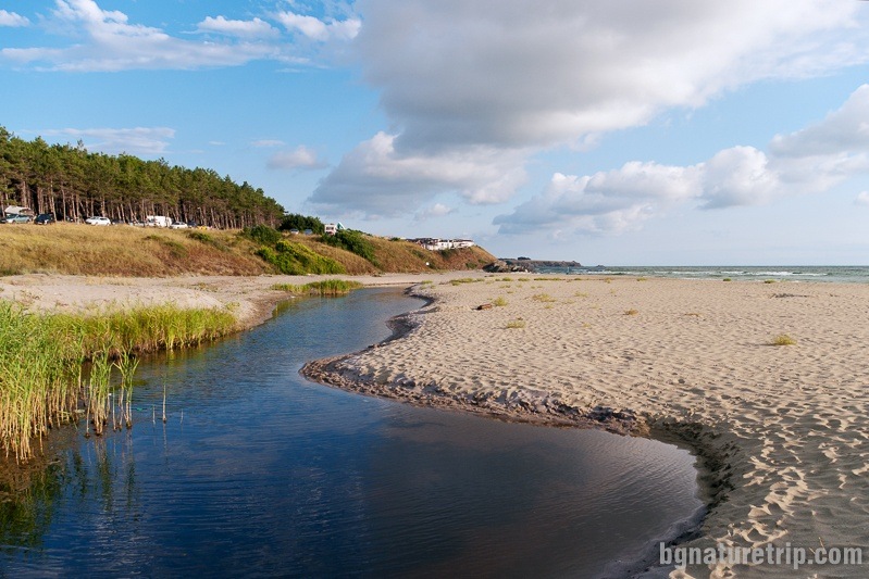
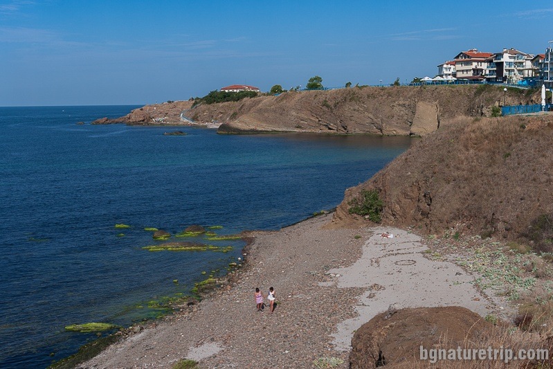
Ahtopol beach
It is 1.8 km long and about 25 m wide. Its location is in a charming bay with green slopes called Lardigo. As a matter of fact, this name has remained from the Greeks who lived here a century ago. The name Lardigo originates from the Greek word “Larus” – Gull in translation. Lifeguards take care of the safety of vacationers. Sunbeds and umbrellas are available, as well as a free area where anyone can place their towel. The beach reaches the “Camping Dolphin” to the north, where bungalows are available. Besides, the rocks give an extra charm on the beach, resembling reefs at its southern end, which, combined with the clear waters, make it attractive to snorkel divers.
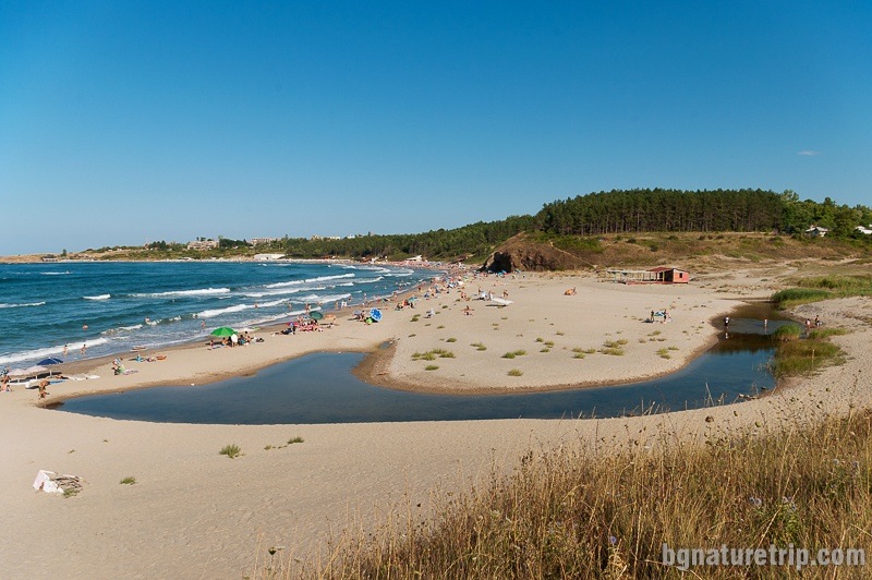
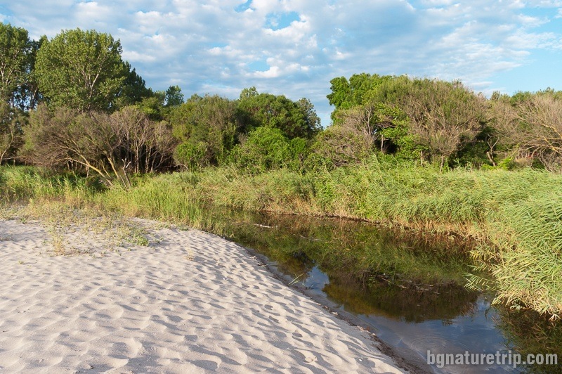
The natural landmark “Nakovo kladenche”
It is a small field around the river Nakovo Dere with an area of 1 ha – from the highway to the beach. Declared a natural landmark and protected area as early as 1980, because it is a habitat for Western Caspian turtle (Mauremys rivulata) and European pond turtle (Emys orbicularis).
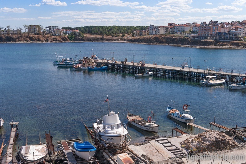
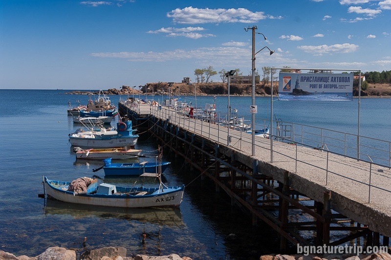
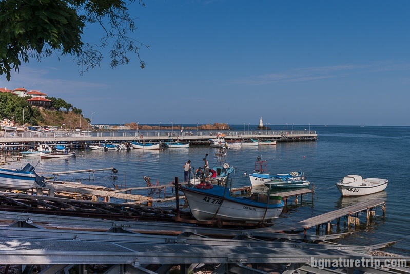
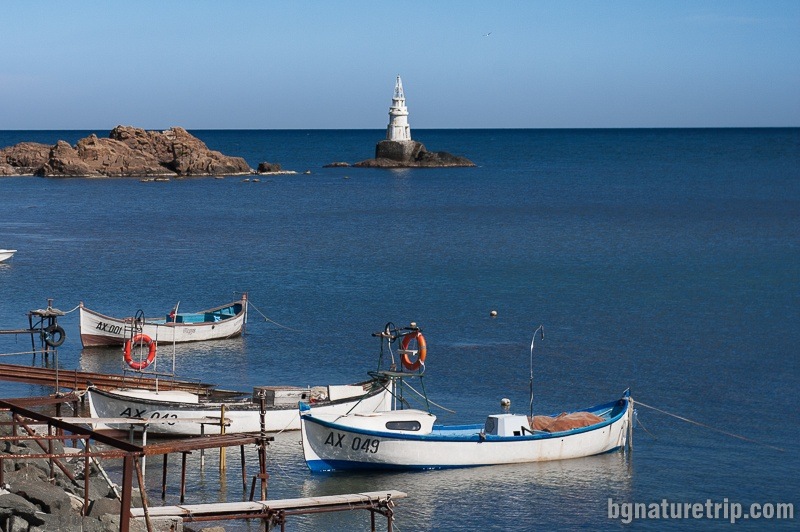
Fishing port and the lighthouse of Ahtopol
Offers for hotels in Ahtopol
Booking.com
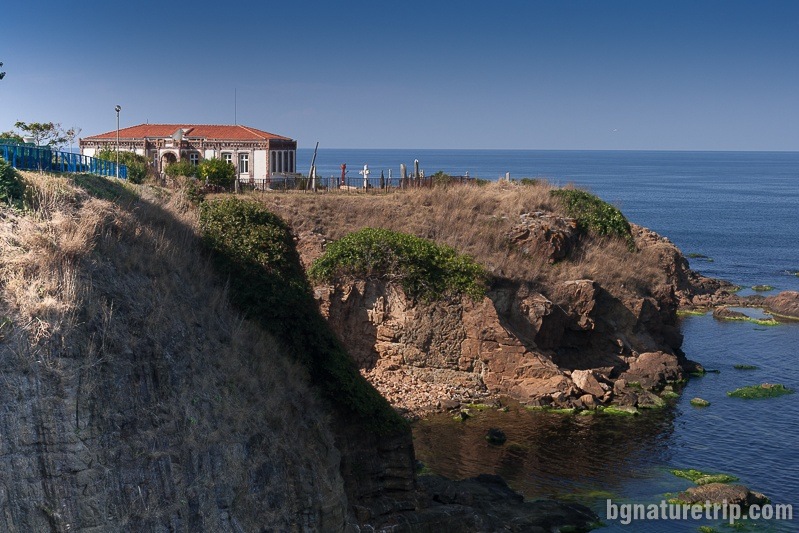
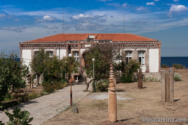
The Greek School
Can see it from far away as a solitary building on the elongated into the sea steep rocky shores. It was built in the early XX century with money provided by Greek immigrants to America and designed by Greek architects. It is lined with red bricks delivered from Marseille (Italy).
At present, it is reconstructed and declared a cultural monument. Students from the National Academy of Arts work here and use it as summer headquarter.
One of the many painted buildings from the Mural Painting Festival that took place in Ahtopol in 2017. Many foreign artists participated in it.
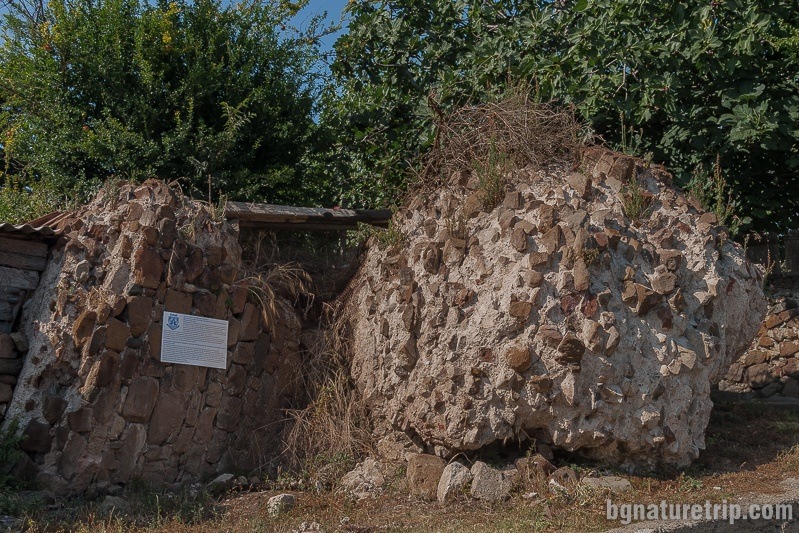
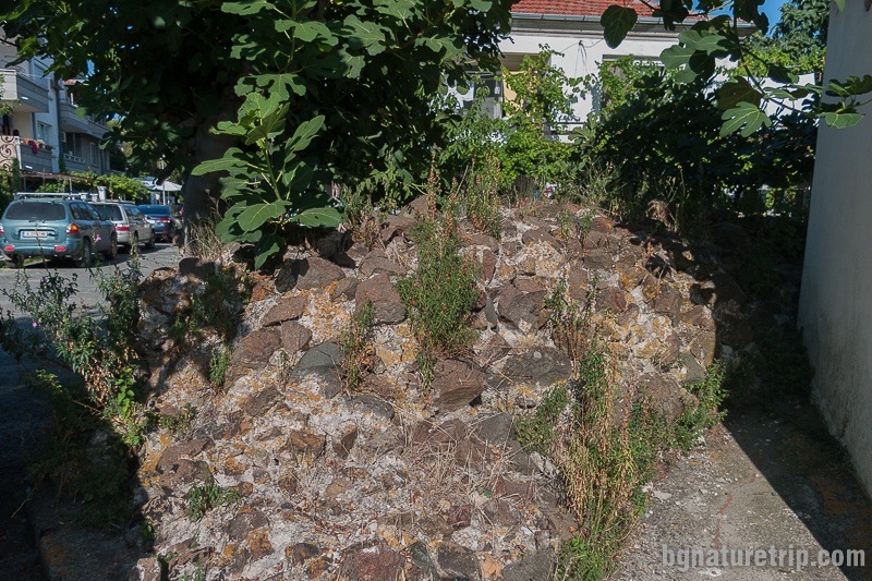
The fortress wall
It was built in the 6th century AD to protect the city from the barbarian tribes, during the Great Migration of the Nations. Later, it was used until the15th century. In that time, it surrounded the whole city, but nowadays, there have been remained only ruins. Of course, you can see them in many places along the promenade, starting from the fishing pier.
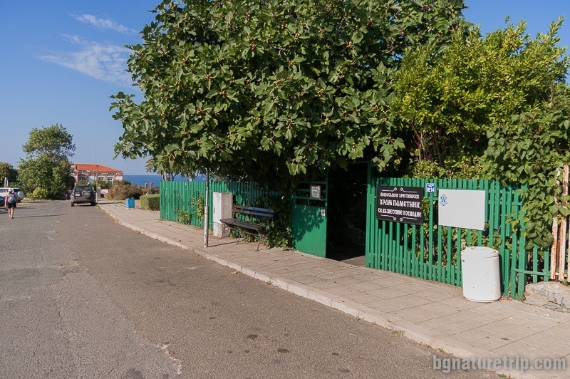
The church “St. Ascension of the Lord”
The church is one nave, one apse with a height of about 2.30 meters. It resembles the most ordinary house in appearance because of the epoch of early Ottoman rule when Christians hadn’t rights to build high churches. It is similar to the churches of “The Most Holy Mother” in Sozopol, as well as” St. Dimitar “in the village of Brushlyan, Strandzha mountain. Depending on the times and economic situation, sometimes that rule was broken, and Christians were allowed to build taller temples. There is no exact dating of the construction and only one Greek inscription that is preserved in the apse, which mentions 1796. Despite, based on its architecture, scientists suggest that the building was built several centuries earlier.
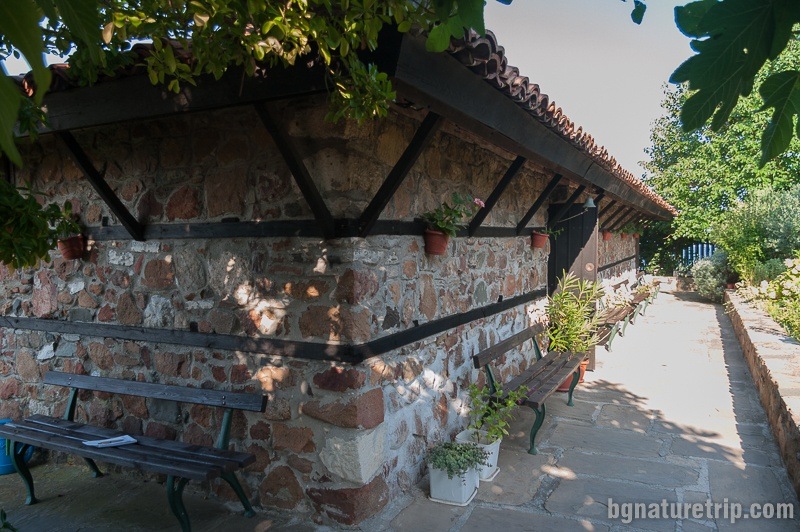
The lighting of the church
What is interesting about the church is the lighting provided by several small windows on the walls. Into the roof, there are large windows – the so-called “upper lighting”. Together with the 90 cm thick walls, the building was much more secure when, in days of an attack, while it was still dangerous outside, the locals were hiding inside.
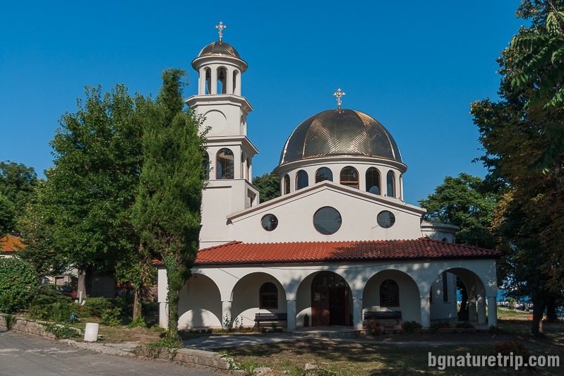
Church of the “Dormition of Theotokos”
Newly built temple, completed in 2011 for the religious needs of local people, due to the lack of other church, except for the described above. It has the same name as the large church, that was located at the highest point on the peninsula. Unfortunately, it was completely burned by a fire in 1918.
Historical notes on Ahtopol
Antiquity
The discovered coins and ceramics on land, as well as the lead and stone anchors removed from the sea, testify the area was inhabited in the 5th – 1st century BC. Probably, Thracians of the Asti, Skirmian, or Tina tribes lived here, but exactly what, it has not yet been identified. Analysing Arian’s travelogue for the coastal road (dating back to 131 AD), scientists suggest that one of the settlements mentioned therein was located here – on the Ahtopol coast. Its name was Avleyteihos, which in Greek means the fortress of Avley. The name Avley is Thracian, which indicates that until that time Greek settlers had not yet populated the town, unlike Apollonia (present-day Sozopol), Anhialo (present-day Pomorie) and Mesambria (present-day Nessebar).
After the Romans settled in these lands in the 1st century AD, the city flourished. Many of the raw materials extracted from the Strandzha Mountains were essential both for the Roman troops and for the new builders who had to urbanise the newly conquered territories. From here they exported timber and metals, construction resources also and food products – fish and animals.
The Middle Ages
During the several centuries of the Great Migration of the Peoples (IV-VII century) came, barbarian tribes of the Goths, Huns and Slavs attacked all of Southeastern Europe. In his effort to preserve Ahtopol, the Byzantine Еmperor Anastasius built a fortress wall (6th century) that surrounded the entire peninsula and whose remains we can see today. As a result, many new settlers began to flock to the well-protected city. Since then Ahtopol has gained its fame as a populous city with a large port.
Acquiring the Greek name Ahtopol and settling of Greeks
The town was also a diocese of the Patriarchate of Constantinople. Probably at that time it acquired the name Agatopol. There are different assumptions about the interpretation of the title since the greek word αγαθα can mean wealth, happiness, and even commodity (in modern Greek).
Presumably, at that time, Greeks-Byzantines settled in the city whose descendants had remained here until 1913.
After the establishment of the Bulgarian State (681 AD), the city’s location was into the border zone with Byzantium, which often changed its outlines over the centuries. In those times the city often changed its status and passed either in Bulgarian territory or in Byzantine territory.
Ottoman ruling
During the Ottoman invasion and the gradual conquest of the Second Bulgarian Kingdom, Agatopol was on the territory of Byzantium. In 1453 the Ottomans engrossed it as well as the whole Byzantium.
In the following centuries, it had an essential role as a port city from which raw materials were exported to the capital of the Ottoman Empire – Constantinople (present-day Istanbul in Turkey). According to the administrative division, the city was the centre of the county of Agatopol. Into that county, there were 12 Strandzha villages, including Sinemorets, Brodilovo and Kosti (at present touristic landmarks). County Agatopol, on the other hand, was subordinated to the region of Anhialo (Pomorie). In that time the city had a predominantly Greek population.
Agatopol was the headquarter of a metropolis in the seventeenth century, and there was a large metropolitan church of the “Dormition of Theotokos”, which, unfortunately, burned down entirely in the fire of 1918.
After Liberation
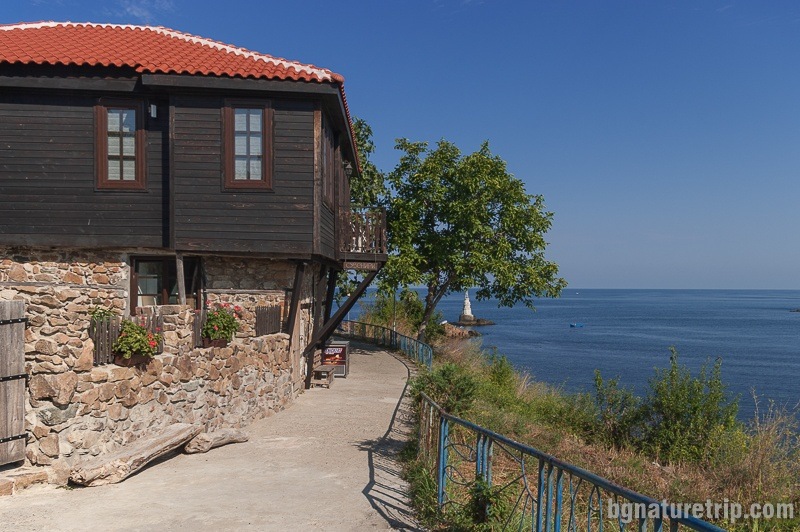
Although liberated from Ottoman rule in 1878, Ahtopol was returned to the Ottoman Empire under the terms of the Berlin Treaty (1878). Finally, It was annexed to the Bulgarian country 35 years later – in 1913 after the First Balkan War. As a result of the strained relations between Bulgarians and Greeks, after the inter-Allied war (or the so-called Second Balkan War), the Greek population of Ahtopol left it. Like all other cities along the Southern Black Sea coast (Pomorie, Nessebar, Sozopol, Primorsko Tsarevo, etc.) after that, Bulgarian refugees from Eastern Thrace settled the town. At that time, the appearance of Ahtopol was very similar to Nessebar, Sozopol and Pomorie with many wooden houses. Unfortunately, like Pomorie, the great fire in 1918 burned almost everything. Only the Church of “St. Ascension of the Lord ” and a single house located along the promenade, survived.
At present, the house has been restored, which led to losing its previous old appearance partially.
Continue of the walk
In case of a more extended stay in Ahtopol, you can walk along the coastal hiking trail leading to Sinemorets past volcanic formations. The route is leading to one of the most lovely places on the Black Sea Coast – the Veleka River Mouth.
Sinemorets ( 6 km in the south), on the other hand, offers a whole range of opportunities for eco walks, exotic beaches and a boat trip on a river past wild banks. 6 km south of Sinemorets lies the famous Silistar Beach, which has attractive natural features.
One more route starting from Ahtopol, but passing through forests is the hiking trail leading to the Strandzha village of Brodilovo. The way follows the slopes of Strandzha mountain. We will prepare a report for it in the future.
Besides, for other beautiful seascapes and historical sites, one can also visit the nearby Tsarevo and Varvara.
In case you wish to get to know with the Strandzha culture – architecture and traditions, as well as with the nature of Strandzha Nature Park, can visit by car the nearby villages of Brodilovo (22 km) and Kosti (37 km), as well as the protected area Marina Reka (27 km).
USEFUL: To get a quick and easy idea of where these places are – see the destinations marked on our Google map. There all the landmarks we’ve written about, are marked as tags with links.
To plan your trip to them, you can use the selection of assistive tools: Google Road Map with calculator in km, flights to Bulgaria, rental cars, weather forecast, hotel search, timetables of buses in the region.
Offers for hotels in Ahtopol
Booking.com