Ahtopol – Sinemorets – hiking trail past volcanic formations to the Veleka Mouth
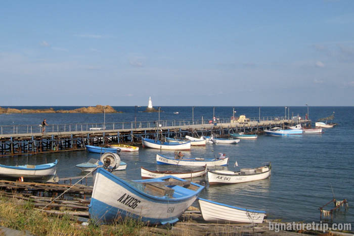
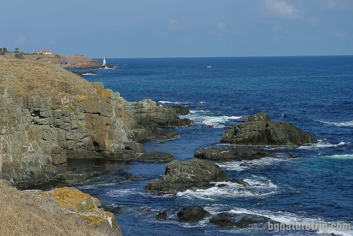
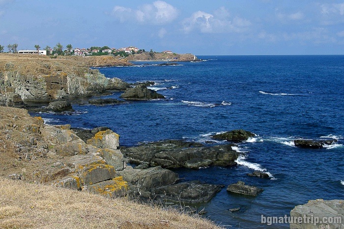
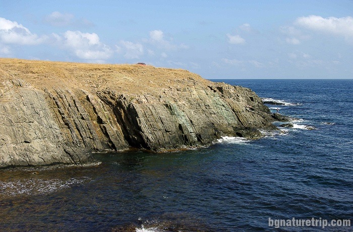
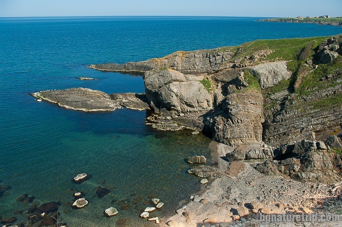
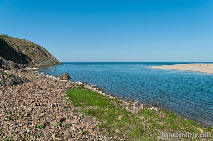
In Ahtopol, at the fishing pier near the lighthouse, is the start of the route past volcanic formations to the Veleka River Mouth. Near the port can park a car. Then, there is walking to the south along the curves of many small bays resembling fjords and rock formations. Тhere are ascents and descents along the entire route because the relief is rugged. At the end of the way, overall, you will reach a steep shore where can see a magnificent view of the Veleka River Mouth near Sinemorets.
Where is the Ahtopol-Sinemorets hiking trail – map, route and GPX file Download file: Ahtopol-Sinemorets-EN.gpx GPX file
USEFUL: For more information on how to open GPX files with a smartphone, see this link .
For planning your visit to the place or accommodation in the nearby settlements, can use the collection of assistive tools – Google Road Map with calculator in km, flights to Bulgaria, rental cars, weather forecast, hotel search, timetables of buses in the region, see this link.
The length of the path from Ahtopol to the place for a panoramic view of the mouth of Veleka River is 5 km and the walking time is 2 hours.
The distance from the mouth of Veleka – to the centre of Sinemorets, where there is a bus stop, is 2.7 km. At the bus stop, there are buses for returning to Ahtopol.
Also, It is possible to combine the walk with a stay at the beach next Veleka River. Later could reach the centre of Sinemorets by walking on the sand. For the purpose of that, the depth of the river, which is variable, has to be checked on-site. If it not so big, eventually you could wade across the river.
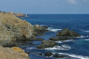
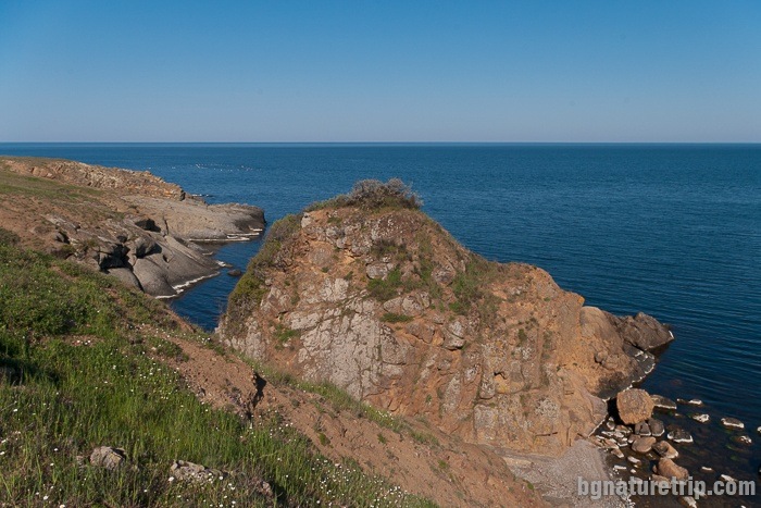
Along the trail, can observe geological phenomena – a consequence of the volcanic activity of the “Goliama Papia” Crater (in the present, peak at Brodilovo village) 80 million years ago in the Upper Cretaceous period. Vertically frozen lava flows that reach the seabed as well as volcanic bombs are just a few of the things that can see.
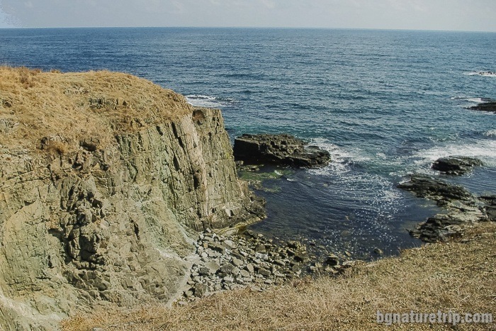
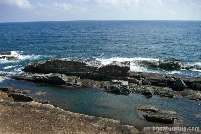
Rock formations past the hiking trail
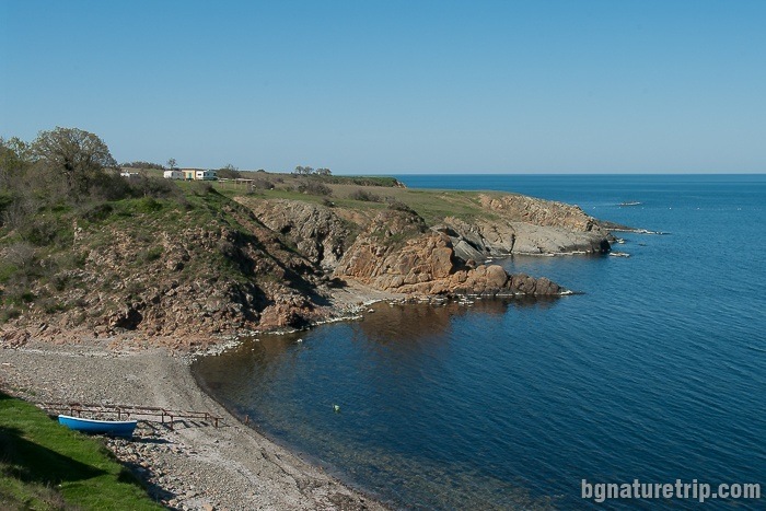
To this bay, there is also a direct dirt road from the main asphalt road for the needs of fishers.
Route features
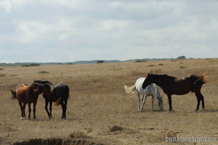
Since almost the entire path is through lawns and there are no trees where can hide for shade, the appropriate time of passage is in the morning or late afternoon when the sun shines less. Together with the beauty of the rock formations, unfortunately, in some places, the lovely views are spoiled by piles of plastic waste thrown from the sea currents in the small bays. Another unpleasant circumstance is related to the many grazing cows and horses whose excretions you should avoid.
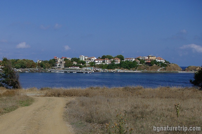
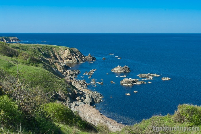
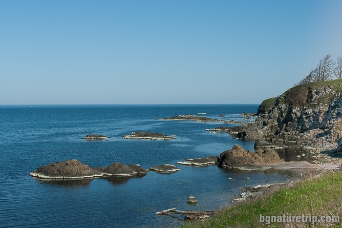
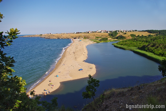
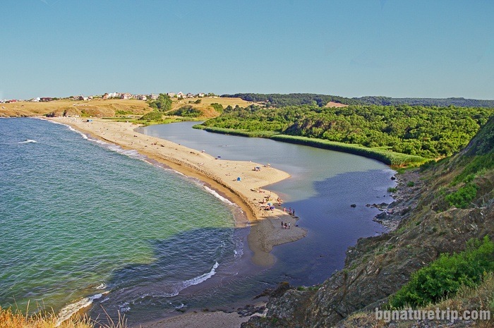
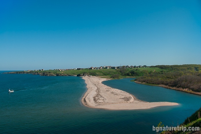
At the end of the trail, as a result, you will find yourself at one of the most beautiful places on the Black Sea Coast – the mouth of the Veleka River.
The Veleka River Mouth
In case you come here in the summer, could visit the beach down, the attached below route as GPX file will help. As mentioned above, this is related to wading across the river. We found this branch by chance in the spring, but we have not personally crossed the river. Must take into account that the depth of the water is variable and have to check it on site. Usually, in the summer, it is low.
If you cross the entire beach, you can reach the centre of Sinemorets, where there is a bus stop to return to Ahtopol. The total length of this route is 2 km.
How to reach the beach below from the high rocks near the mouth of Veleka River Download file: Veleka-Beach-EN.gpx GPX file
Another way to get to Sinemorets is to go through the forest
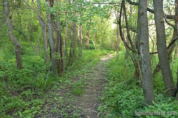
In this way will reach the main asphalt road Ahtopol – Sinemorets. It is further walking on the steel bridge over the Veleka River and after that walking on the asphalt road to reach the village of Sinemorets where is the bus stop (this route is indicated in the first GPX file). The length of this crossing is 2.7 km. According to last observations (the spring of 2018), the path through the forest is not in good condition – it is quite grassy in places, and there may be large mud puddles. So it would be wise to equip yourself with hiking shoes or sneakers. In case you visit this place in the summer or the spring, there is a danger of ticks, so take the necessary precautions. Also in the summer – it’s possible to meet whole swarms of annoying flies typical for Strandzha mountain. So it is advisable to wear a hat and dark glasses that could somewhat protect you.
Preservation of the protected area “Veleka River Mouth”
The entire area from Ahtopol to the Veleka River Mouth is into the territory of a Protected Area “The Veleka River Mouth. Also, it has forest status, and it is a part of Strandzha Nature Park and the European ecological network Natura 2000. Therefore some rules should be observed when visiting to protect natural resources.
To put it briefly – do not throw away waste, do not tear plants, do not light a fire, no camping, and let the place look like you’ve found it!
For more details, or if you intend to carry out particular activities other than a tourist walk, the full text of the laws can read here.
- Protected area “Veleka River Mouth” – current prohibitions and regimes ( the page of Bulgarian “Executive Environment Agency”)
- Strandzha Nature Park – current prohibitions and regimes ( the page of Bulgarian “Executive Environment Agency”)
- Bulgarian Forestry Act
More information on bus timetables:
Visit this link http://avtogaratsarevo.eu/timetableforbuses.html
Continue of the walk
Another interesting eco-trail in the area of Sinemorets, where can observe beautiful bays and volcanic formations, is the one leading to the wild Lipite Beach, and along its extension to reach the wild Listi Beach and the civilised Silistar Beach.
Another excellent opportunity is to take a boat trip along the Veleka River.
In case you are planning a more extended stay in Ahtopol, you can also visit the nearby Tsarevo and Varvara for other beautiful beaches, views and landmarks.
USEFUL: To get a quick and easy idea of where these places are – see the destinations marked on our Google map. There all the landmarks we’ve written about, are marked as tags with links.
To plan your trip to them, you can use the selection of assistive tools: Google Road Map with calculator in km, flights to Bulgaria, rental cars, weather forecast, hotel search, timetables of buses in the region.
Offers for hotels in Ahtopol
Booking.com