Kosti village: The secret waterfall Kazancheto
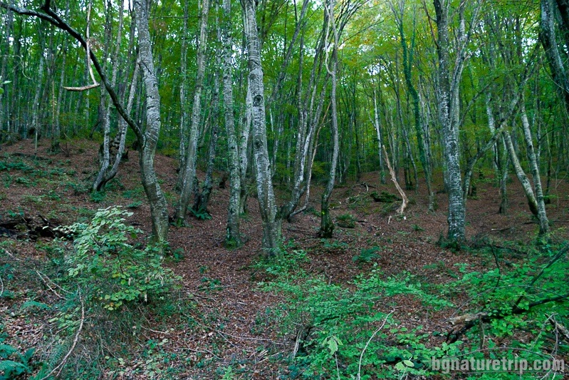
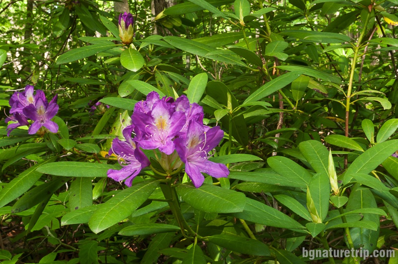
Here is another opportunity for a nice eco-walk in the vicinity of the Strandzha village of Kosti – the path to the “Bogorodishki Dol” area. Along this adventure trail, one moves through astonish old-growing forest past the Veleka River. Finally – at the shelter of “Bogorodishki Dol” can see the secret small waterfall “Kazancheto”, as well as seeing the beautiful and rare plant that has become a symbol of Strandzha – Rhododendron ponticum (Black sea rhododendron in translation).
How to get to “Bogorodishki dol” area and “Kazancheto” waterfall near Kosti village in Strandzha mountain – map, route and GPX file Download file: Kosti-Kazancheto-Waterfall-EN.gpx GPX file
USEFUL: For more information on how to open GPX files with a smartphone, see this link .
For planning your visit to the place or accommodation in the nearby settlements, can use the collection of assistive tools – Google Road Map with calculator in km, flights to Bulgaria, rental cars, weather forecast, hotel search, timetables of buses in the region, see this link.
Route features
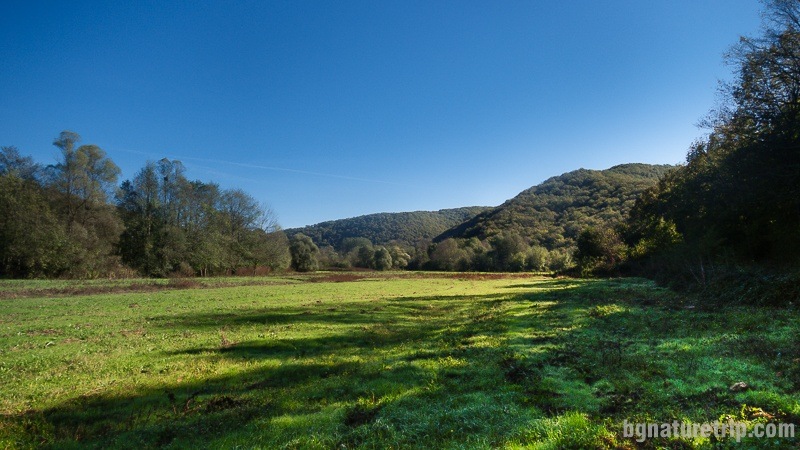
The length of the whole route is 4.9 km in one direction with a displacement of 60 m. The walk takes about 1 hour and 30 minutes in one direction. It is suitable for people over 12 years of age, and its difficulty is rated as “medium”. Because there are many branches along the way that can lead you in the wrong direction, GPS or the assistance of guide are a must.
It is a good idea when you are making this hike to equip yourself with hiking shoes or sneakers and long trousers, because of the steep ascent in the middle of the route, as well as the narrow paths with low grass in some places. In case you visit this place in the summer or the spring, there is a danger of ticks, so take the necessary precautions. Also in the summer – it’s possible to meet whole swarms of annoying flies typical for Strandzha mountain. So it is advisable to wear a hat and dark glasses that could somewhat protect you.
According to the information board, the most appropriate time for the hike is March-September. Undoubtedly, the most beautiful views, one can see in May, when is the flowering of the Rhododendron ponticum that inhabits “Bogorodishki Dol” area.
Although we made this hike in October, we were indeed delighted.
Updated on 02/03/2019
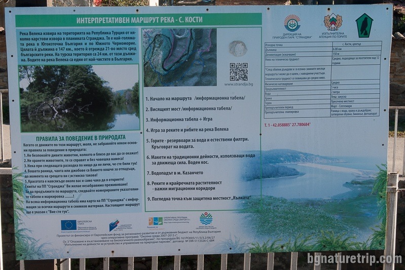
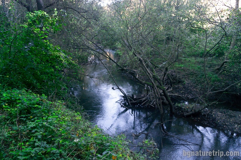
Until recently, the crossing Veleka River by a rope bridge has been a part of the route. The information board located in the square of Kosti still describes this possibility. At the present time, as the rope bridge has been declared dangerous, moving on it is forbidden !!!
The attached GPX file indicates another way to cross the Veleka River – via a massive bridge that cars move. This opportunity was provided to us by the Strandzha Nature Park Direction. We have not personally crossed this section of the route, because we had crossed the rope bridge when it had been in acceptable condition. In the report below, we describe the stretch “Remains from the railway line” – Bogorodishki Dol”.
To date, as you read these rows, it is possible that the rope bridge was repaired and the ban was removed. When crossing the rope bridge, the route is shortened by 1.5 km compared to the crossing the massive deck. In case you undertake the hike, you can ask the locals about the actual condition of the rope bridge. In the GPX file above, the coordinates of it are indicated by a flag and the description “Rope bridge Veleka.”
The start of the route
The beginning of the walk is at Kosti village Square, where can park a car, and there is an information board of the course.
Further, there is walking in the west direction to the outskirts of the settlement, where is the massive bridge for crossing the Veleka River.
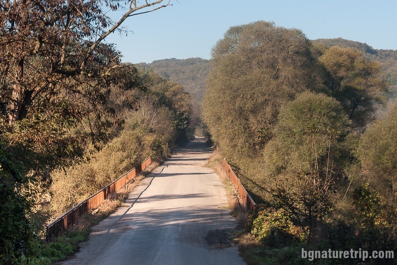
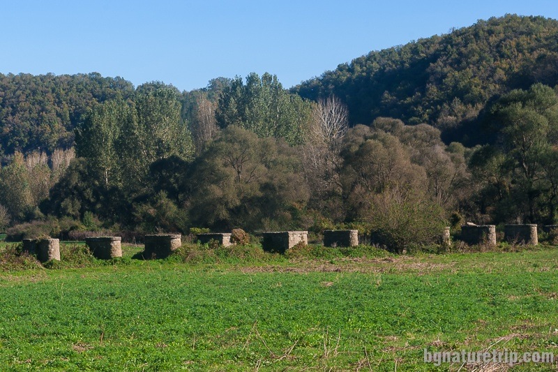
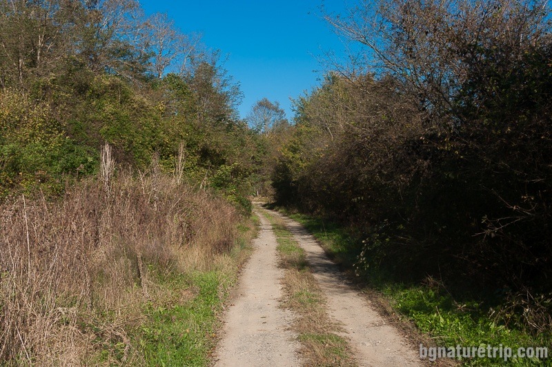
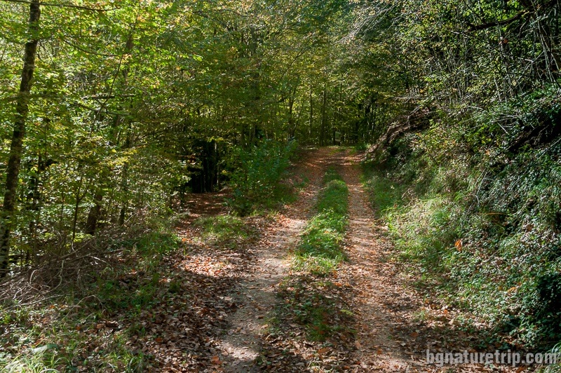
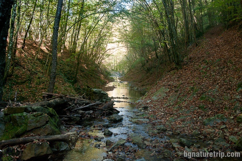
Shortly after its passage, one turns left and follows a dirt forest road by the river. 1.5 km further, passes by the remains of the former railway line of the Kosti – Brodilovo – Ahtopol narrow-gauge railway. In the past, people had used it for the transportation of timber, but later they dismantled it in the mid-20th century because they considered it as ineffective.
Wide dirt road along the Veleka River
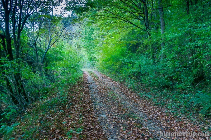
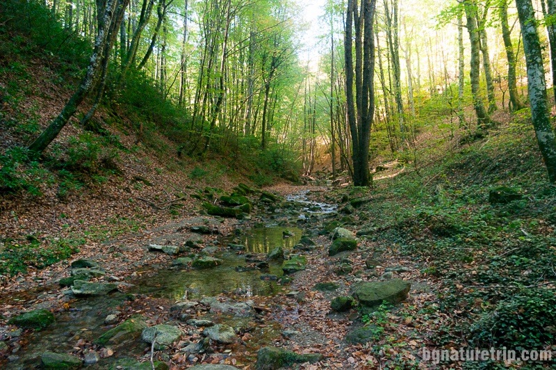
After passing the remains of the railway line, the route goes on along the Veleka River. The road is wide and through dense forest, and the Forestry vehicles probably used it.
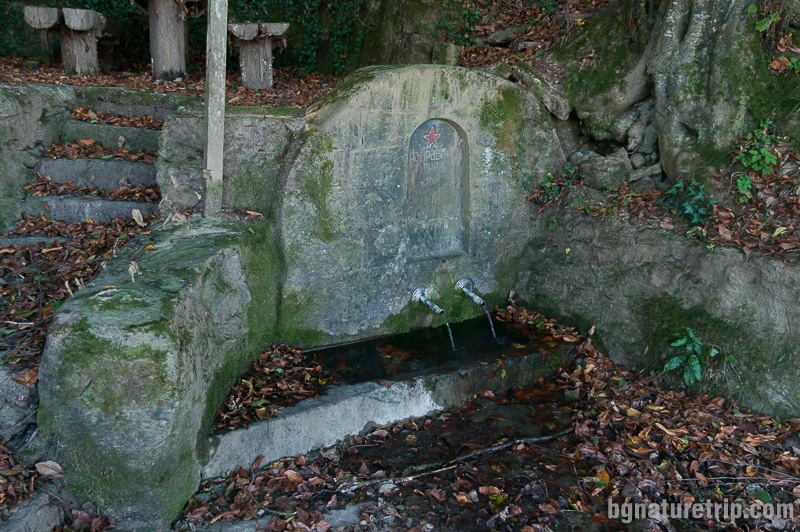
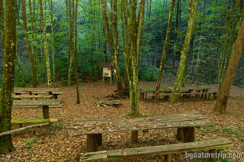
There is a small shelter with a fountain called “Kreynero”. This name was leftover from the Greeks who lived in Kosti village a century ago. In fact, the name came from the cold water that flows from the tap and gives coolness in the summer. “Cryo – Nero” (in Greek κρύο νερό) literally means “cold water”.
Kreynero Shelter for rest and picnic
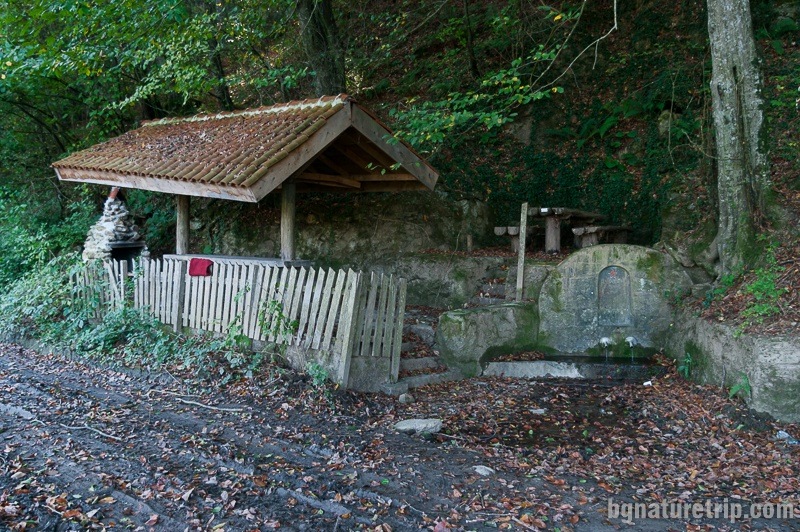
From the information board, we learned that the area is a habitat of Corncrake (Crex crex), Marsh frog (Pelophylax ridibundus), Smooth newt (Lissotriton Vulgaris), European glass lizard ( Pseudopus apodus ) and others. Important to realize is that all of them are rare and protected species according to the Bulgarian law.
The plants we shot along the Veleka River:
[supsystic-gallery id=’9′]
Rural tourism in Kosti village – guesthouses as accommodation offer
Booking.com
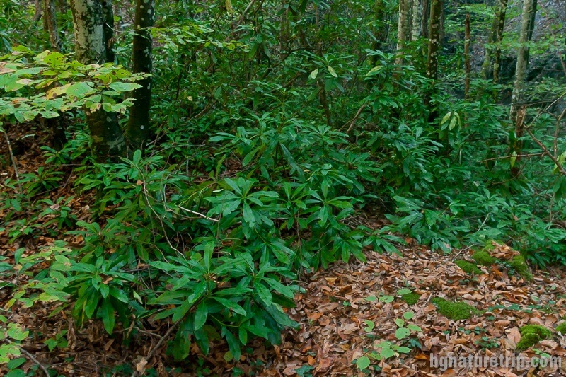
One kilometre after the Krainero shelter, there is a turn right. There, one has to deviate from the road along the Veleka River and climb a very steep path. It is reaching the ridge of a hill. Indeed, this was the most challenging part of the hike – the length of the climb is 250 m and the displacement – 45 m. Therefore the average slope angle is 10 °. Further, there is a descent into “Bogorodishki dol”, where there is a shelter with tables and benches and a habitat of the rare, forbidden and protected by law plant “Rhododendron ponticum” (Black sea rhododendron in translation)
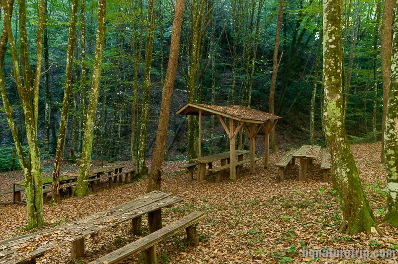
Bogorodishki Dol ( “The valley of Our Lady” in translation)
In the valley passes the eponymous small river “Bogorodishki Dol”, which flows into the river Veleka. Its waters are cold and swift and are a habitat of one freshwater crab (Potamon ibericum) species as well as Agile frog (Rana dalmatina).
A locality of the rare Rhododendron ponticum, emblematic for Strandzha mountain
It is protected by law and forbidden for tearing. At the time of our visit in autumn, its bloom has long disappeared.
Our Lady holiday
Local people highly respect Our Lady and believe she is one of the patrons of the village of Kosti. Every summer in August, when is the Christian holiday of the Assumption, people of Kosti village gather here to pay their homage to Blessed Virgin Mary. A solemn liturgy takes place, and a priest sanctifies the food for health and well-being. They visit a small chapel that lays on the other side of the river and to reach it they cross the river. For this purpose in the recent past, there had been a small wooden bridge which, unfortunately, it was not available at the time of our visit.
“Our Lady” chapel and the oldest beech in Strandzha mountain
For this reason, we didn’t reach the chapel. As we learned later, locals wade in the river to get to the chapel. Perhaps the water level is low in the summer, and locals wade in the water without much effort. The applied coordinates in the GPX file, where the small temple should be, are borrowed from the BGmountains electronic map. We will expect those of you who like to be explorers, to share their impressions. Furthermore, from what we have learned from other guides – about one kilometre south-east of the chapel lies the oldest beech in Strandzha Mountain – 800 years old. Could reach it by a path whose start is at the chapel.
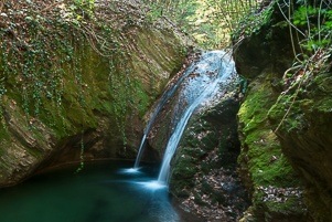
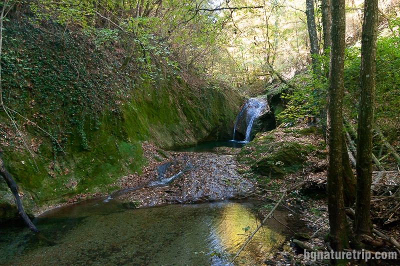
Waterfall “Kazancheto”
Into “Bogorodishki Dol” area there is a beautiful small waterfall called “Kazancheto”. To reach it, have to go on about 100 meters past the tables and the shelter along the main path. After that, there is a descending on wooden steps with a railing. Have to go down with extreme caution as the steps are very slippery.
The waters of the waterfall are falling into a small stream that locals likened to “the cauldron” (“Kazancheto” in Bulgarian). For this reason, they chose that name.
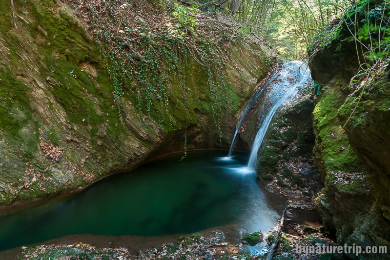
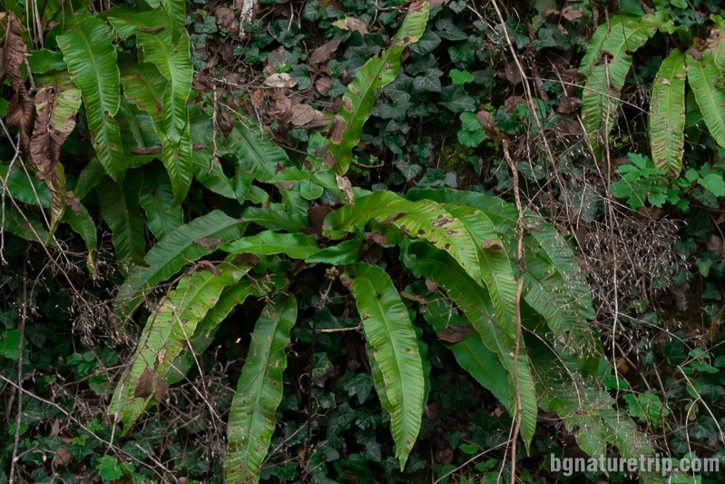
On the sheer cliffs near the waterfall, we saw the rare species of Hart’s-tongue fern (Phyllitis scolopendrium). The species is forbidden to tear!
Preservation of nature
The entire area where is the eco-trail lays into the territory of Strandzha Nature Park and the European ecological network Natura 2000. Also, it has a forest status. Therefore some rules should be observed when visiting to protect natural resources.
To put it briefly – do not throw away waste, do not tear plants, do not light a fire, no camping, and let the place look like you’ve found it!
For more details, or if you intend to carry out particular activities other than a tourist walk, the full text of the laws can read here.
- Strandzha Nature Park – current prohibitions and regimes ( the page of Bulgarian “Executive Environment Agency”)
- Bulgarian Forestry Act
Transport to Kosti village
There is also a bus to the village of Kosti, that departs in the early morning and afternoon from Tsarevo city, for more information you can see this link – http://avtogaratsarevo.eu/
What else can see near Kosti village
- Kosti village and the 14 brothers oaks. On this link will find additional information about Kosti village, as a rural tourism destination, as well as photos of the old wooden houses and the church, which is one of the most beautiful in Strandzha mountain.
- The second option is the “Raikov Vir” waterfall. There you can also see the Rhododendron ponticum
- A third opportunity is to visit “Diado Valcho” Peak and Protected area “Briar root” near the Silkosia Reserve.
Continue the trip
In case you drive in the west direction to Malko Tarnovo, you can pop in the villages of Balgari, Kondolovo and Gramatikovo for more eco-trails, nature and historical landmarks as well as see old wooden houses – representatives of the Strandzha architecture style.
In case you drive in the east, towards the Black Sea, you can visit the area “Marina Reka” for one more hiking trail past lovely forest with rare plants that. After that can continue to the Black Sea resorts Tsarevo, Varvara, Ahtopol or Primorsko (north) for other landmarks, beaches and lovely seascapes.
USEFUL: To get a quick and easy idea of where these places are – see the destinations marked on our Google map. There all the landmarks we’ve written about, are marked as tags with links.
Also, to plan your trip to them, you can use the selection of assistive tools: Google Road Map with calculator in km, flights to Bulgaria, rental cars, weather forecast, hotel search, timetables of buses in the region.
Offers for hotels nearby in Tsarevo city
Booking.com