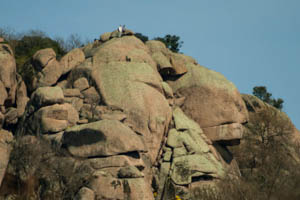
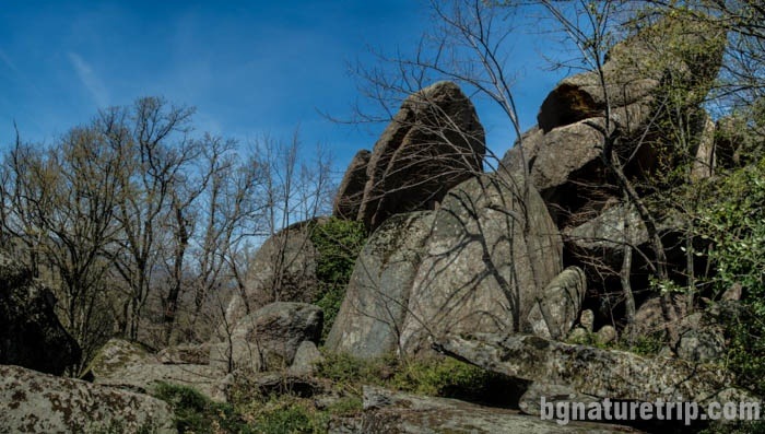
Primorsko: Rock formation “Lion’s Head” and a fortress
The “Lion’s head” (“Lavskata glava” in Bulgarian) is a part of Ropotamo Reserve near Primorsko, Bulgaria. It is a rock formation composed of syenite blocks and declared as a natural landmark. Its age is 65-70 million years, and it rises 80 meters above the Ropotamo River in a stretch where the trunk road Sozopol – Primorsko runs parallel to the river. It has great popularity because it is noticeable by travelling cars on the road. In proximity to the “Lion’s head” (300 meters of it) you can go by one of the hiking trails in Ropotamo Reserve.
The place attracts tourists because of the beautiful forest nature, rugged relief, panoramic views of the surrounding area, as well as the opportunity to see objects of archaeological significance. It is suitable for hikers, came for a vacation at the Black Sea coast. In the early Iron Age, it was built an ancient city, and its fortress was used until the 19th century when was named “Valchanovo Kale” (“Valchan’s fortress” in Bulgarian).
A view of the “Lion’s Head” from the trunk road Sozopol – Primorsko
Route features
Compared to all the other hiking trails in Ropotamo Reserve, the path leading to the “Lion’s Head” hill is the most difficult and requires more endurance and adventurous spirit. In some places there are steep climbs and downhills, passing through tall shrubs and smooth rocks, so suitable equipment for this route are hiking shoes or sneakers, long trousers and insect spray. If you go along this route in the summer – it’s possible to meet whole swarms of annoying flies. It is advisable to wear a hat and dark glasses that could somewhat protect you.
As a summary, the features of the road are as follows:
Length: 2 km
Displacement – 170 m
time to pass: 1 hour in one direction
How to get to the vicinity of the Lion’s Head and the Valchanovo kale – map, route and GPX file: Download file: Lion-Head-en.gpx GPX file
USEFUL: For more information on how to open GPX files with a smartphone, see this link .
For planning your visit to the place or accommodation in the nearby settlements, can use the collection of assistive tools – Google Road Map with calculator in km, flights to Bulgaria, rental cars, weather forecast, hotel search, timetables of buses in the region, see this link.
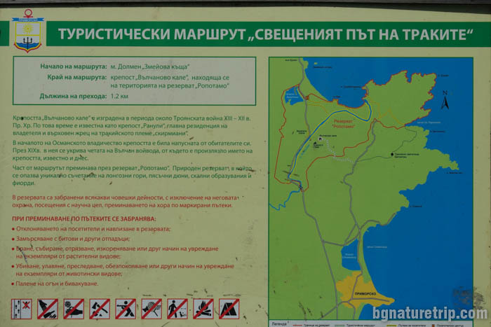
To get to the beginning of the hiking trail, you have to go to the town of Primorsko and reach the exit for the Thracian sanctuary Beglik Tash (how to achieve it can you see from here). After that, you can park a car at the beginning of the stretch leading to the ancient sanctuary Beglik Tash. Fifty meters before the parking, on the left, is the beginning of the eco path through the grass. There is a large information board with a map.
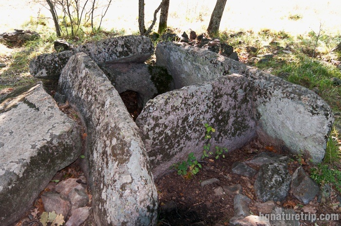
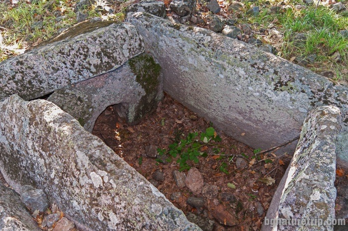
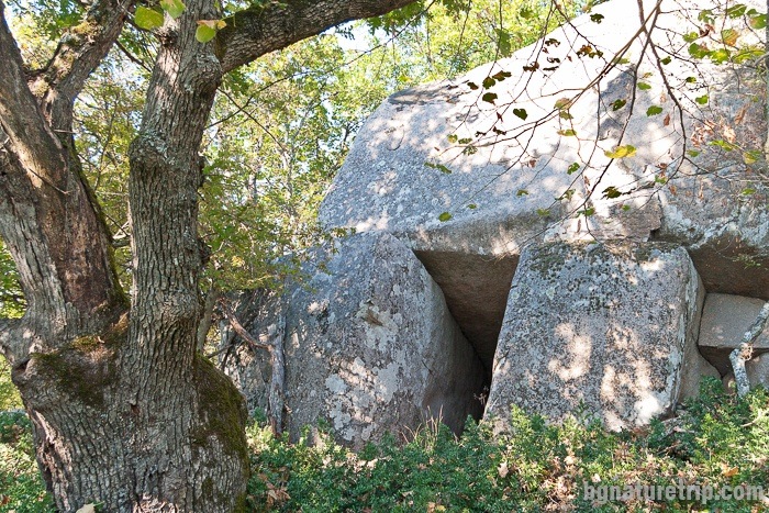
Dolmen “Zmeiuva kashta”
At the very beginning of the path, near the asphalt road, there is an ancient Thracian dolmen called “Zmeiuva kashta” ( “Dragon’s house” in translation). It is a small and shallow rectangular structure of large stone blocks. Also, there is another large block near it that once served as a cover. In ancient times the Thracians buried the rulers in these megalithic buildings. Dolmens are most common in Strandzha, Sakar and the Eastern Rhodopes, and are rare in the rest of the country.
Protect the Ropotamo Reserve
Because the way passes through the Ropotamo Reserve, there are specific rules you should observe when pass. They aim at preserving natural resources. Some of them, essential for hikers, is written ( in Bulgarian) on the information board.
In short: forbidden lighting a fire, camping, plant cutting, passage on unmarked paths, disturbing of wild animals and others.
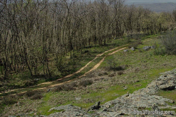
Description of the route leading to the Lion’s Head vicinity
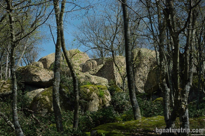
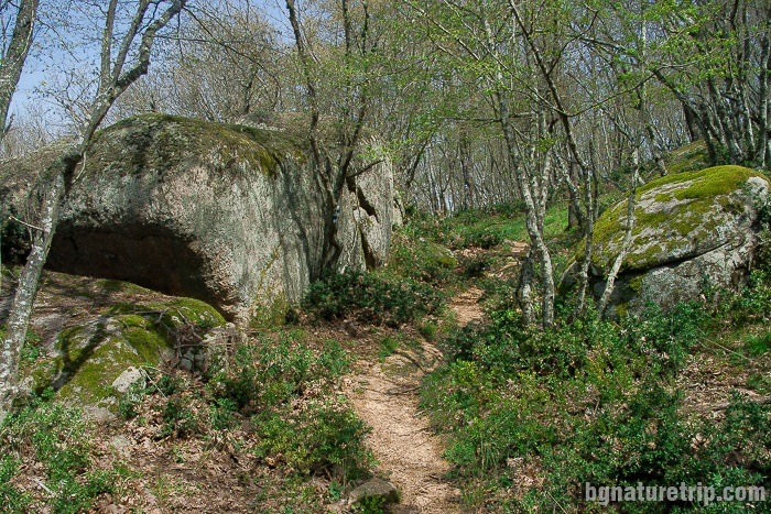
The first 1 kilometre of the trail has a full width, as can be seen in these photographs:
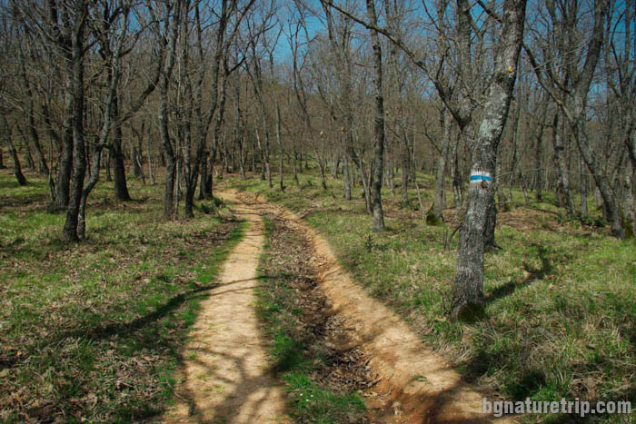
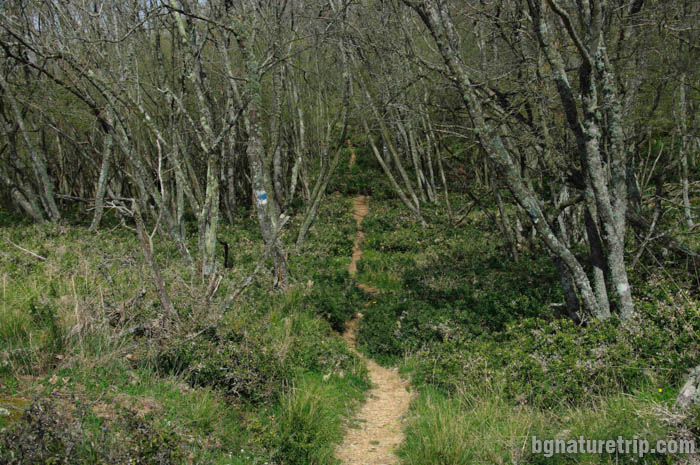
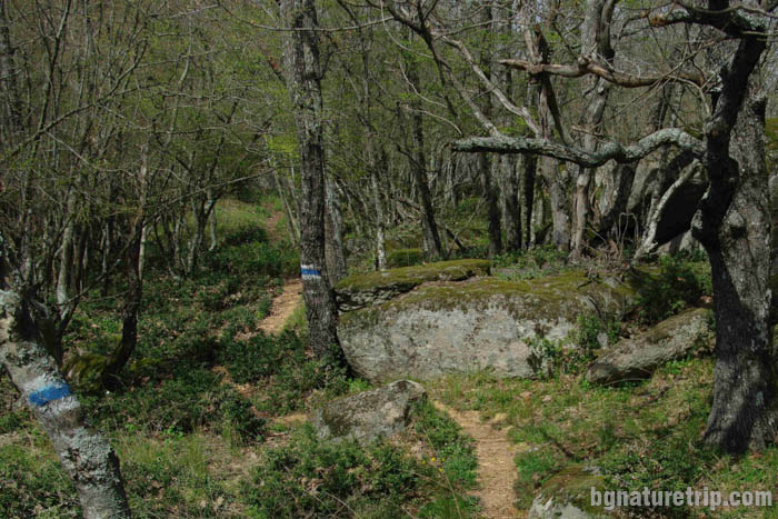
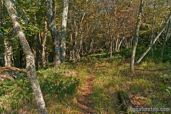
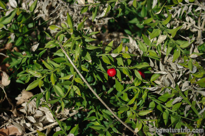
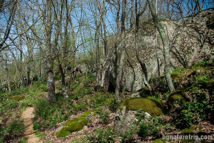
Over the next 1 kilometre, the path narrows in the bushes butcher’s broom (Ruscus aculeatus).In some places, it is almost invisible. In this reason, you should follow the blue-white marking on the trees – the mark of the Regional Inspectorate of Environment and Waters in Burgas, under whose management the Reserve is.
There are information panels at certain distances for the plants and animal species, who inhabit the area. According to them, here is a habitat of the rare sea eagle (Haliaeetus albicilla) and also the viper (Vipera ammodytes).
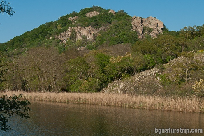
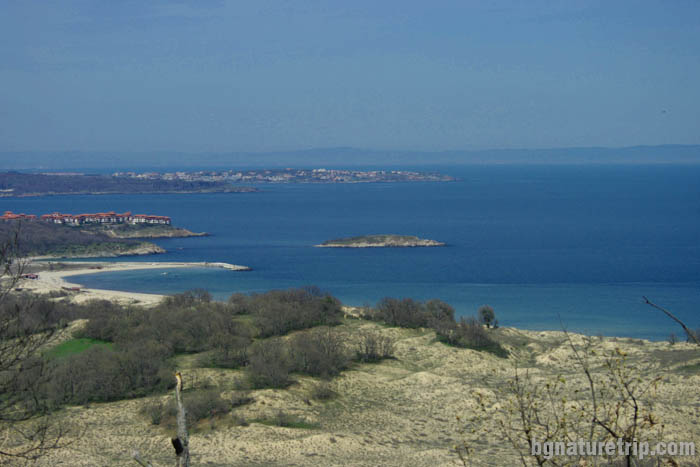
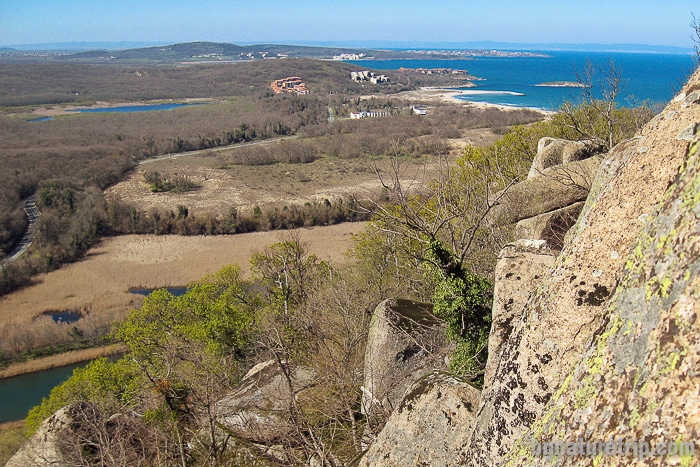
Looking to the right of the path, through the branches of the trees you can see a beautiful view of Arkutino and Snake’s island:
Offers for hotels in Primorsko
Booking.com
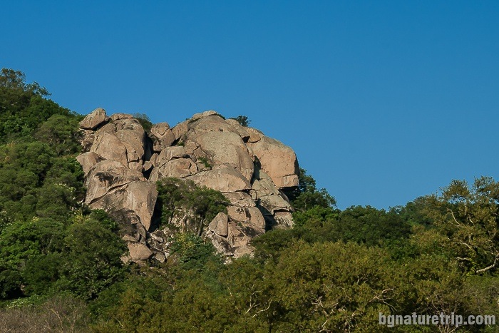
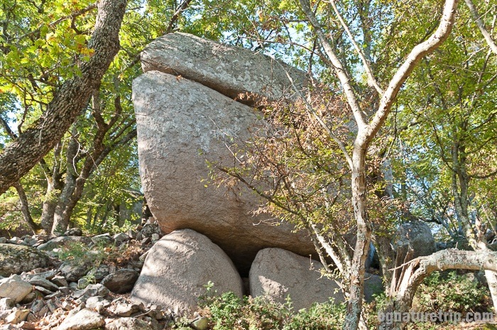
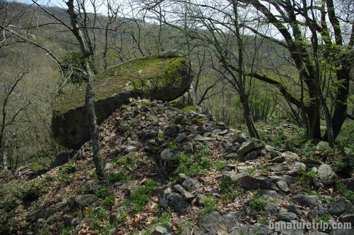
Ancient megalithic blocks along the trail to the Lion’s Head
In many places, you can see rounded megalithic blocks, the same as those at Beglik Tash – the result of the volcanic activity of Mount Kitka in the Late Cretaceous (65-70 million years ago).
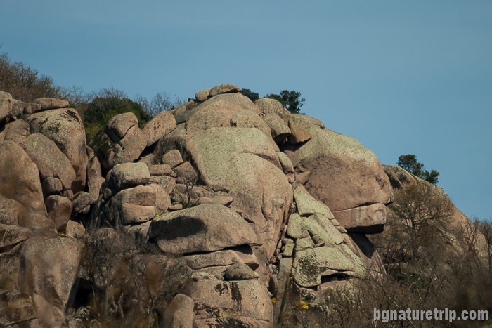
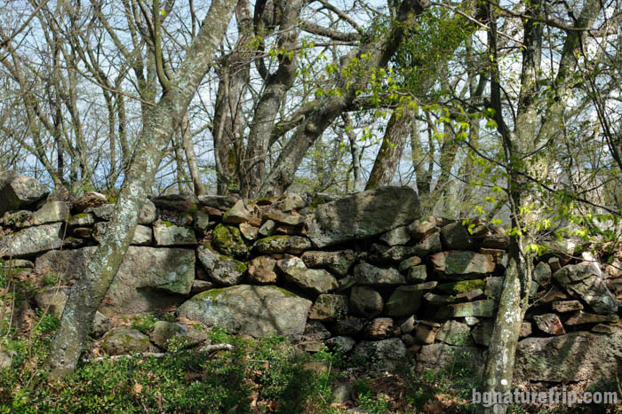
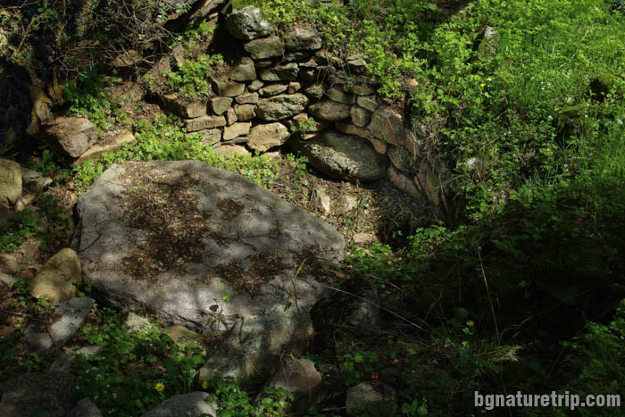
The ancient fortress “Valchanovo Kale” around the Lion’s Head
At the end of the route, on a ridge of a hill, there is an information board. It is the same as the one at the beginning of the path. It indicates that you have reached the fortress “Valchanovo kale”.
Until now, archaeologists haven’t made excavations, but only partial observations. According to them, the old inhabitants have been treated large megalithic blocks and arranged them to form walls and buildings. That way of building was native for the ancient fortresses in the Mediterranean in 2nd-1st millennium BC.
In our estimation – after so many years, the stone blocks have already been displaced. Therefore for ordinary tourists who are non-specialists, it is difficult to distinguish between construction and natural boulders. We were able to see in one place only, stones, that looks like people had arranged them.
In the flat area, they built barricades of a lot of smaller stone blocks. We saw them on the right of the marked path near the last information board:
History of the place
The Thracians Scirmians built the fort. They were a tribe dealing with mining. They also built and the sanctuary Beglik – Tash.
The total area occupied by the ancient city is 30 acres, surrounded by a fortress. Taking into account the features of the region: the high hill where the location of the fort is, the proximity of the Ropotamo River and the port of Cape “Maslen Nos” – the place was strategic.
Based on the antiquities found – people inhabited the area from the Iron age to the Middle Ages. Romans, Byzantines and Bulgarians lived here. During the Turkish domination ( XIV – XIX century), the place became deserted.
Valchan voivoda inhabited the fort
At the beginning of the XIX century, the detachment of Valchan voivoda (National Bulgarian hero) used it as a hiding place. Therefore, the fortress was named after him and became “Valchan’s fortress” (Valchanovo kale in Bulgarian). He was a defender of the Bulgarian people, and he did a lot of good deeds in those troubled times of slavery. Also, another famous name of the fort is Ranuli. This is the name of a medieval fortress mentioned in decree called “Hambarliski” inscription. It is issued by the Bulgarian monarch Khan Krum in 812. They are taking into account the historical facts and all the other geographical objects mentioned in the decree and as result scientists claim that the equalising of the Ranuli Fortress with the “Valchan’s fortress” is highly possible.
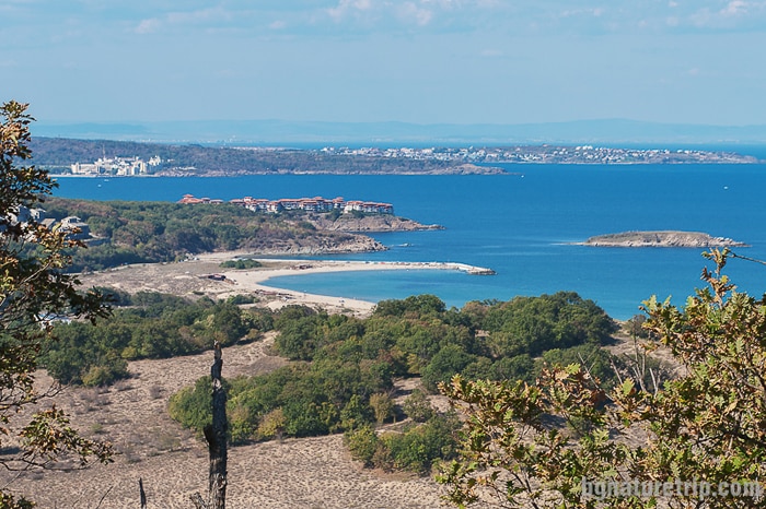
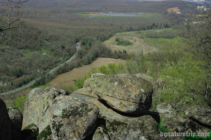
Reaching the northeastern part of the peak you can see a beautiful view. Can be observed Arkutino marsh and the main asphalt road connecting Sozopol and Primorsko.
IMPORTANT
From here to the Lion’s Head, the distance is 300 meters in the southwest direction, but unfortunately, the paths that reach the Lion’s Head are not allowed for passing. The red markings on the trees have been laid by amateur mountaineers but not by the staff of the Regional Inspectorate of Environment and Water – Bourgas – the white-blue signing is missing. The hike is accompanied by many difficulties – going through very tall shrubs and climbing megalithic blocks. Although many researchers and photographers reached Lion’s Head over the years (there are many pictures on the Internet), according to the order of Ropotamo Reserve, this is a violation that is subject to monetary sanctions!
Continue the walk
When you come back to the asphalt road, we recommend using some of the following paths in the Reserve and its surrounding.
- A way to the –Ancient Thracian sanctuary Beglik Tash, which is also the closest place. It is a starting point for hiking trails to other historical sites and scenic landscapes – Bay “St. Paraskeva”, Cape “Maslen nos”.
- A hiking trail to the mouth of the Ropotamo River
For the other paths and landmarks in Ropotamo Reserve – look at the attached here map.
If you are planning a more extended stay in the area, it is a good idea to choose Primorsko as a city for staying. It has many hotels and lodgings and can offer many entertainments to diversify your holiday at Bulgarian Black Sea Coast.
Offers for hotels in Primorsko
Booking.com