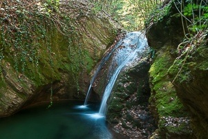
Kosti village ecotourism: Trail to Raykov Vir waterfall
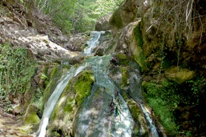
To the “Raykov Vir” Waterfall is one more hiking trail, near the lovely village of Kosti – a destination for ecotourism and rural tourism. In fact, we learned about this short and easy route from the “Rhododendron ponticum Festival” which in 2019 took place right here – in the village of Kosti, nearby Tsarevo city on the Black Sea Coast.
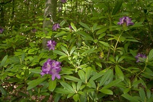
Like the route leading to the “Kazancheto” waterfall, this one will also take you to a small secret waterfall, and along the way will see in many places the rare plant and symbol for Strandzha – the Rhododendron ponticum.
Read more… “Kosti village ecotourism: Trail to Raykov Vir waterfall”