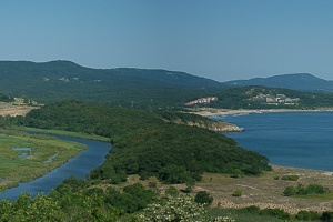
Primorsko: From Arkutino to the mouth of the Ropotamo River
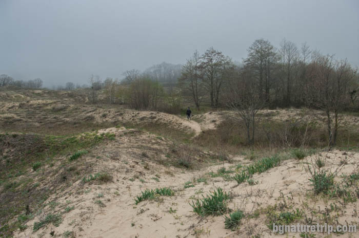
As an alternative way to reach the mouth of the Ropotamo River, except for the hiking trail starting from Primorsko, there is also an eco-path whose start is at Arkutino Beach. Sequently is passing through Cape Caya and continues to the mouth. The path consists of an alternation of dunes and forest and the route is smooth and relatively flat. Along the way, you can see many rare sandy plants, moreover and the bizarre rock formations of Cape Kaya. This route belongs to Ropotamo Reserve.
How to reach the mouth of the Ropotamo River, Primorsko through Arkutino Dunes and Cape Kaya – map, route and GPX file Download file: Arkutino-Cape-Kaya-Ropotamo-EN.gpx GPX file
USEFUL: For more information on how to open GPX files with a smartphone, see this link .
For planning your visit to the place or accommodation in the nearby settlements, can use the collection of assistive tools – Google Road Map with calculator in km, flights to Bulgaria, rental cars, weather forecast, hotel search, timetables of buses in the region, see this link.
Length: 3.7 km
Displacement – 33m
Travel time – 1 hour in one direction
An appropriate and safe place to park the car is in the parking lot in front of the swamp Arkutino (7 km before Primorsko) or to use the parking lot in front of the hotel complex close to Arkutino Beach. The reason for that is because there is nowhere to park at the start of the hiking trail.
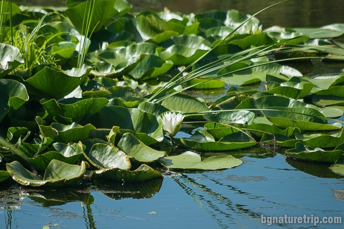
The swamp Arkutino
Also, a visit the hiking trail in the summer can combine with a visit to the Arkutino swamp. Translated from Greek, it means “The Bear’s Swamp” (αρκούδα – meaning bear). Its location is close to the main road, behind the parking lot.
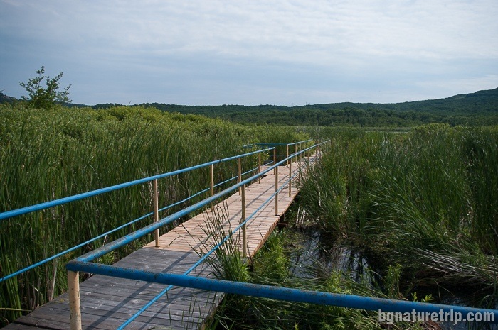
Due to heavy rainfall in recent years, populations of white water lilies have declined sharply, and now the surviving plants are quite far from the bridge. If you want to photograph them, it is advisable to have a camera that zooms in at least four times. The marsh belongs to the territory of the Ropotamo Reserve.
There are two options for joining the hiking trail leading to the mouth of the Ropotamo River – to go along the asphalt road in the direction of Primorsko or to go along the sandy strip of Arkutino Beach. As can be seen, in the GPX file above, there are both routes – going on the asphalt, returning through Arkutino beach. Below there is a description of each of the options.
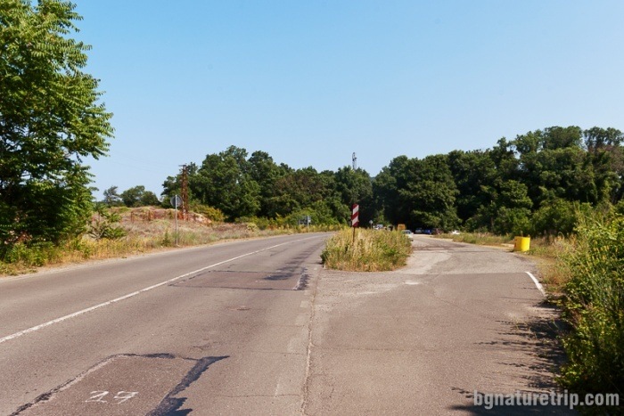
1. The first possibility – walking along the asphalt road
Further on, one has to walk 700 m with caution along the main asphalt road Sozopol-Primorsko, due to the passing traffic of cars. The start of the eco-trail is with a slot in the traffic barrier looking like this:
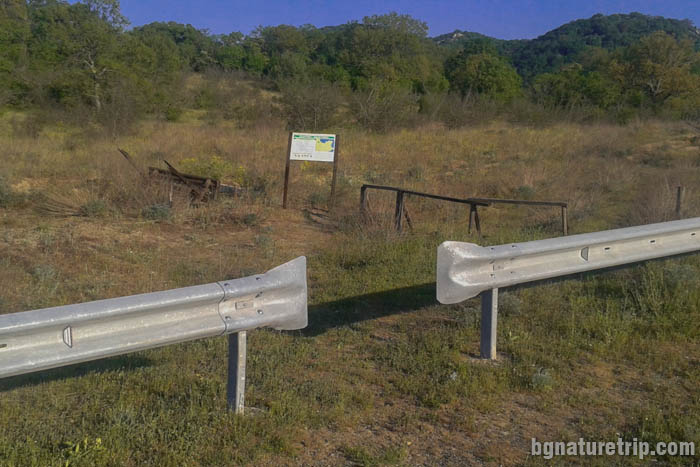
There is also a plate with a map of the Ropotamo Reserve, that shows the route.
Protection of the Ropotamo Reserve
From this point is the entry into the Reserve, and that requires the observance of specific rules: forbidden lighting a fire, camping, plant cutting, going out of the defined hiking trails, disturbing of wild animals and driving with a motor vehicle.
For more details, or if you intend to carry out particular activities other than a simple tourist walk, see this page with links leading to the full text of the laws and exact borders.
Route description
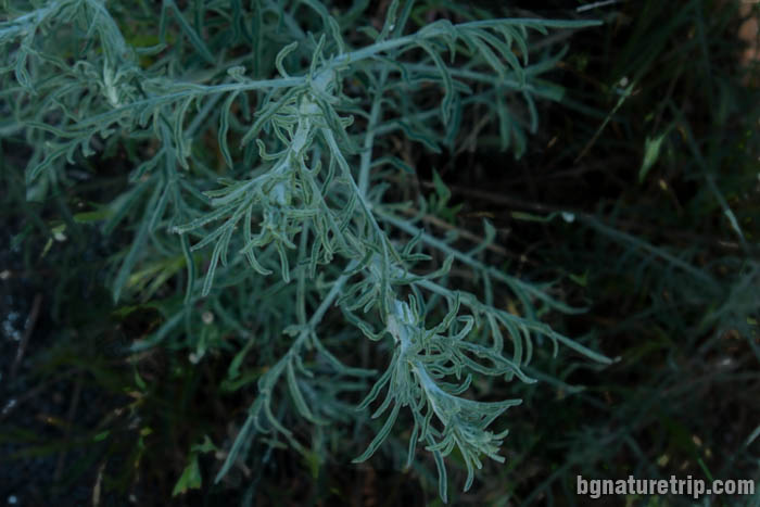
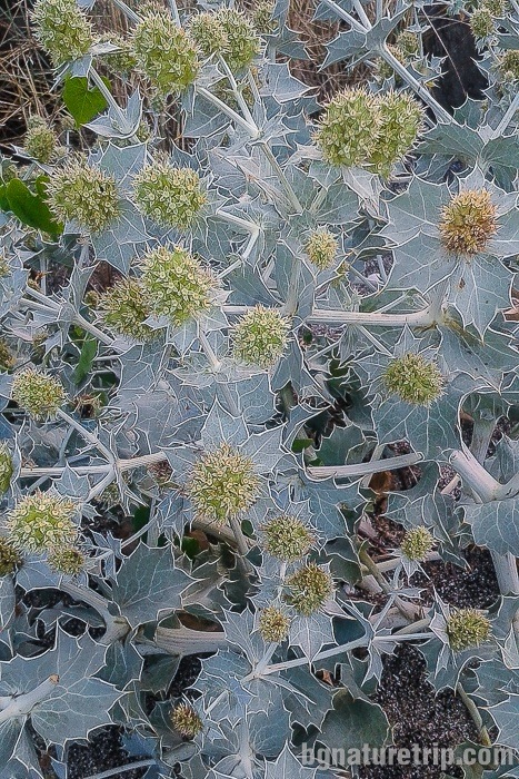
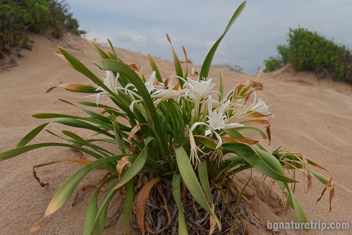
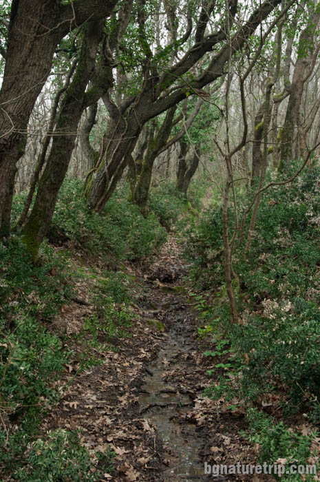
Further, there is a walk through the dunes of Arkutino Bay, where can see the rare plants Sea wormwood, Seaside eryngo, Sea daffodil and more.
Deals on hotels in the Arkutino area
Booking.com
2. The second option – hike along Arkutino beach
This option is related to a walk about 1 km along Arkutino Beach. Walking in the sand may not be as pleasant, but it is much safer than moving along the main road with passing cars, which is described above. Here can see sandy plants and stunning views of Cape Kaya
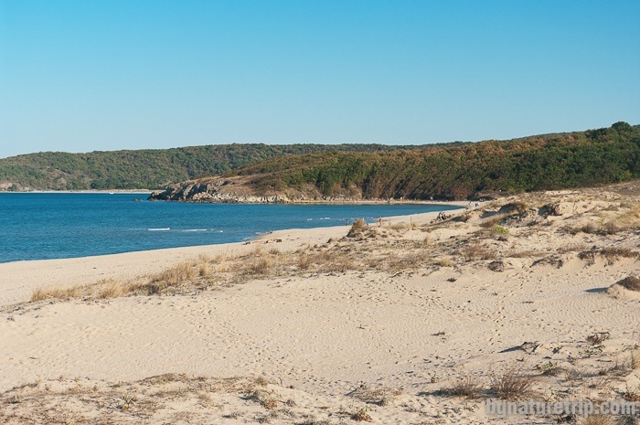
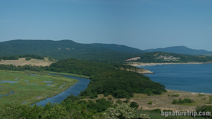
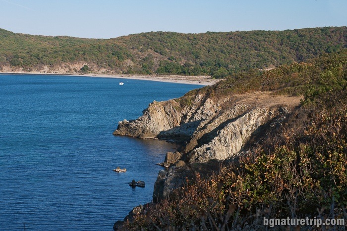
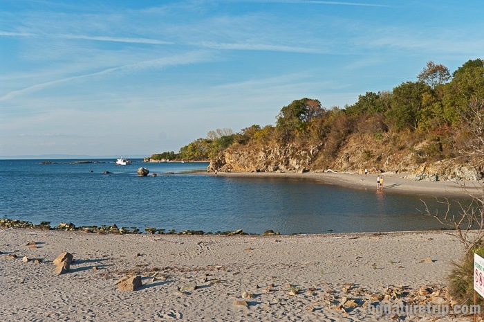
To the left is the Ropotamo River and to the right is Cape Kaya.
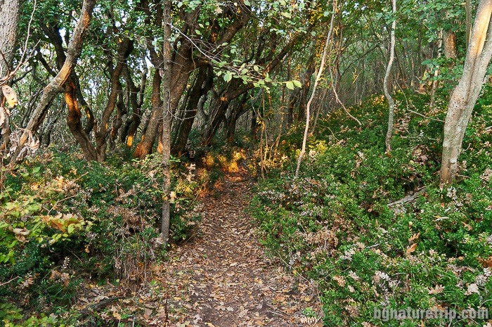
As this point is the entry to the Cape Kaya forest, in fact, it is the entry into the territory of Ropotamo Reserve. The wood is the boundary between Arkutino Beach and Ropotamo Reserve.
Accordingly, entry into Reserve requires the observance of the rules mentioned above: forbidden lighting a fire, camping, plant cutting, going out of the defined hiking trails, disturbing of wild animals and driving with a motor vehicle.
For more details, or if you intend to carry out particular activities other than a simple tourist walk, see this page with links leading to the full text of the laws and exact borders.
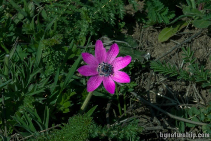
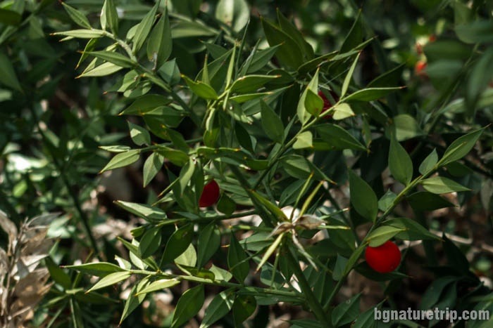
This forest is a habitat of the Windflower, Fritillaria pontica and the Butcher’ s-broom, as can learn from the information boards.
Cape Kaya
The name Kaya itself comes from Turkish and means stone. An explanation for this is the Cape looked from the sea stands out between the dunes from both sides.
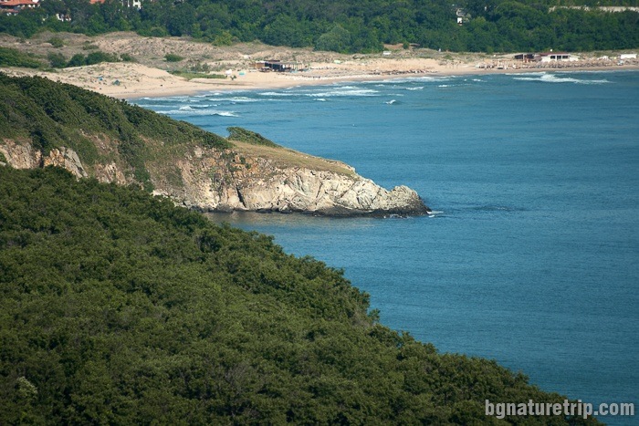
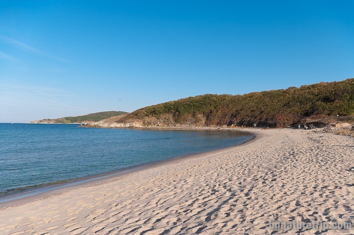
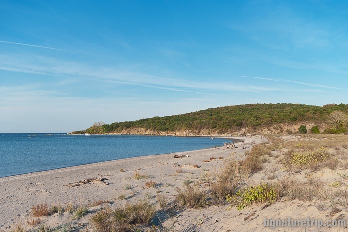
At the end of the forest, you will find yourself again on dunes. After walking on the sand, will reach the mouth of the Ropotamo river.
Ropotamo River
Unfortunately, it is good to know that because the beach stripes are part of Ropotamo Reserve, according to the order in it, stay for bathing and sunbathing is forbidden!
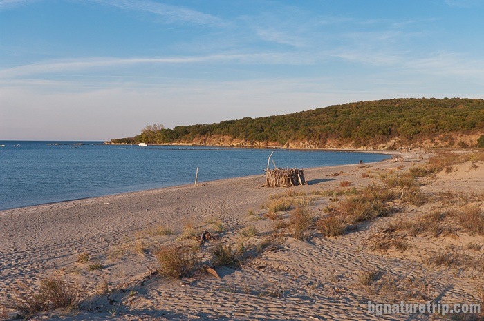
The mouth of the Ropotamo River
Unlike the asphalt road, you will find yourself here on the north side of the Ropotamo estuary. The only way back is the reverse, because its impossible to cross the river. The reason for this is the great depth of the river.
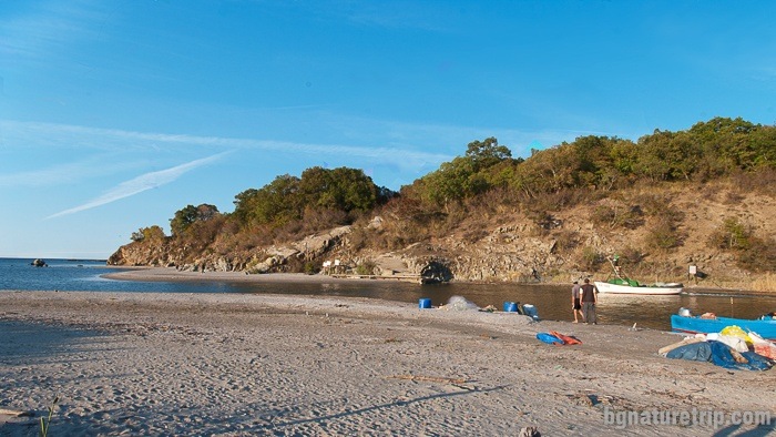
Many fishing boats come here in the spring and fall when the seawater around is rich in fish.
If you come in the summer – then you can combine this walk with sunbathing on Arkutino beach, which is one beautiful place.
Another way to get to the mouth of the Ropotamo River is to walk across the Reserve after you enter the town of Primorsko.
After coming back to Arkutino Beach, there are some other suggestions to diversify your holiday in the area.
What else to see around the Arкutino Beach
In the south direction, you can try the following suggestions:
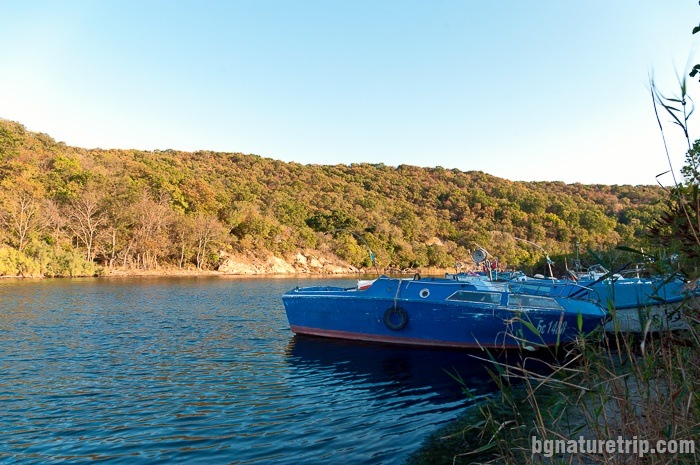
- Boat trip along the Ropotamo River. The point where the boats start is 4.5 km from here in the direction of Primorsko
- The town of Primorsko (8.5 km), its beaches and museum
- Ancient Thracian sanctuary Beglik Tash (13 km)
- Ropotamo Reserve and the many hiking trails around forest and sea (14 km)
In the north direction, can try the following suggestions:
- The wild “Chauffeurs’ Beach” in Alepu area (3.5 km)
- Rock Formation, similar to a fjord, at Cape Agalina (8 km)
- Sozopol City with its beaches and historical sites (13 km)
USEFUL: To get a quick and easy idea of where these places are – see the destinations marked on our Google map. There all the landmarks we’ve written about, are marked as tags with links.
To plan your trip to them, you can use the selection of assistive tools: Google Road Map with calculator in km, flights to Bulgaria, rental cars, weather forecast, hotel search, timetables of buses in the region.
Offers for hotels in Primorsko
Booking.com